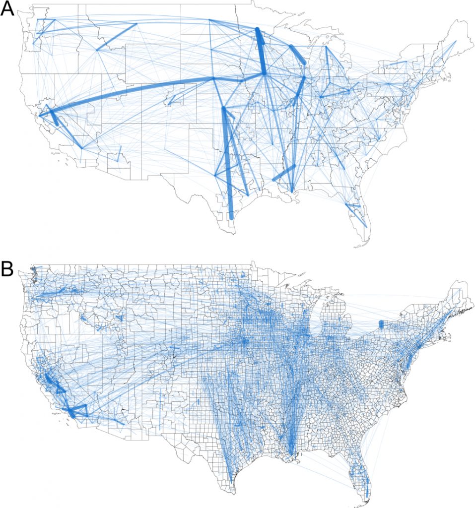
Residents in each U.S. county can see how they are connected to all other counties in the country via food transfers. Overall, there are 9.5 million links between counties on our map.
All Americans, from urban to rural are connected through the food system. Consumers all rely on distant producers, agricultural processing plants, food storage like grain silos and grocery stores, and food transportation systems.
Below: Maps of food flow networks within the United States. Maps depict total food flows (tons) for the (A) FAF and (B) county scale. Links are shown for all FAF data and for the largest 5% of county links.
Read More: The first map of America’s food supply chain is mind-boggling
Article w/methodology: Food flows between counties in the United States