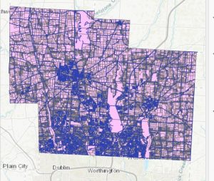
Parcel:
This dataset consists of polygons that represent the parcel lines within Delaware County; these are cadastral geometries. The geometries are maintained by the Delaware County Auditor’s GIS office.
Street Centerline:
This dataset is based on the State of Ohio Location Based Response System; it depicts the center of private and public roads within Delaware County.
Condo:
This data set consists of all condominium polygons within Delaware County, Ohio that have been recorded with the Delaware County Recorder’s Office.
Subdivision:
This data set consists of all subdivisions and condos recorded in the Delaware County Recorder’s Office.
Zipcode:
This is a set of data that contains all the ZIP codes within Delaware County.
School District:
This dataset consists of all school districts in Delaware County, Ohio.
Building Outlines 2024:
This is a set of data that consists of the building outlines as of 2024.
Building outline 2023:
This is a set of data that consists of the building outlines as of 2023.
Building outline 2021:
This is a set of data that consists of the building outlines as of 2021.
Original Township:
This dataset shows the original boundaries of the townships in Delaware County, Ohio, before tax district changes modified their shapes.
Township:
This dataset consists of 19 different townships that make up Delaware County, Ohio.
Precincts:
This dataset consists of Voting Precincts within Delaware County, Ohio. This dataset is maintained by the Delaware County Auditor’s GIS Office under the direction of the Delaware.
County Board of Elections.
This dataset is updated on an as-needed basis and is published as needed by the Delaware County Board of Elections.
Delaware County contours:
2018 two-foot contours. In file geodatabase format.
PLSS:
The PLSS is the Public Land Survey System, which consists of polygons. This dataset was created to help identify all the PLSS and their boundaries in both US Military and Virginia Military Survey Districts of Delaware County.
Railroads:
This dataset allows a user to view the locations of railroads that lie within Delaware County.
2024 aerial imagery:
This is a dataset of the aerial imagery from 2024.
Delaware country E911 Data:
This data set is a spatially accurate representation of all certified addresses within Delaware County. This layer provides the capability to reverse geocode a set of coordinates to determine the closest valid address, for things like 911 calls.
Address point:
This is a dataset that contains the centroid of a building as an address point.
Map sheet:
This dataset consists of all map sheets within Delaware County, Ohio
Farm lot:
This is a set of data that has farm lots from both the US Military and the Virginia Military Survey.
Annexation:
This dataset contains Delaware County’s annexations and conforming boundaries from 1853 to present.
Survey:
This dataset is a shapefile, which is from surveys that were scanned in and saved as PDFs. These represent surveys of land within Delaware County.
Tax district:
This dataset is defined by Delaware County’s Auditor’s Real Estate office, of all the tax districts within Delaware County.
Hydrology:
This set of data has all the major waterways within Delaware County. This data was enhanced using LIDAR-based data in 2018.
GPS:
This data has all the GPS monuments that were established from 1991- 1997.
Dedicated ROW:
This set is the set of lines that have the Right-of-Way within Delaware County.
MSAG:
The MSAG is the Master Street Address Guide, which is a set of polygons of the 28 political jurisdictions. This dataset was created to show the process of locating boundaries within Delaware County.
Recorded Document:
These are documents in the dataset represented as points. These points can be subdivisions, centerline surveys, or miscellaneous documents within Delaware County.
Municipality:
This dataset consists of all municipalities within Delaware County, Ohio.
Here is the photo of the layers of Parcel, Hydrology, and Street Center Line.