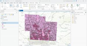
Delaware County GIS Data Inventory
- Address Point: spatially accurate representation of all addresses within the county that indicates the centroid of buildings. Used largely by emergency response teams.
- Parcel: polygons that represent all cadastral parcel lines within the county.
- Recorded Document: Points that represent recorded documents in the county recorder’s plat books. Documents include: vacations, subdivisions, centerline surveys, surveys, annexations, and miscellaneous documents in the county as it relates to the cadastral landbase.
- Zip Code: All zip codes in the county
- School District: All school districts in the county
- Map Sheet: All map sheets in the county
- PLSS: All of the Public Land Survey System (PLSS) polygons in both the US military and Virginia military survey districts of the county. Aids in identifying all of the PLSS and boundaries in both military survey districts in the county.
- MSAG: Master Street Address Guide polygon featureset of the townships, cities and villages that make up the county. Created to locate boundaries of the cities, townships, and villages of the county.
- Municipality: All Municipalities within the county
- Farm Lot: farmlots in both US and Virginia military survey districts of the county. Created to identify farmlot boundaries.
- Township: The 19 townships that make up the county
- Street Centerline: Lines running down the middle of all paved roads in the county
- Annexation: contains annexations and conforming boundaries from 1853 to present
- Condo: All condominium polygons within the county recorded by the county recorders office.
- Subdivision: All subdivisions and condos recorded in the county recorders office.
- Dedicated ROW: All lines that are designated Right-Of-Way within the county.
- Precincts: Voting Precincts in the county
- Survey: shapefile of a point coverage that represents surveys of land within the county.
- Tax District: All tax districts within the county defined by the county Auditors Real Estate Office. Data is dissolved on the Tax District code.
- Building Outline 2021, 2023, 2024: Building outline structures for all years. All years included for comparison.
- Railroads: Allows users to view locations of railroads within the county.
- Delaware County E911 Data: spatially accurate representation of all addresses in the county. Address points indicate building centroid. Used for appraisal mapping, 911, accident reporting, geocoding, and disaster management.