Chapter 7 was the most familiar to me in the maps we’ve seen in GIS. I enjoyed the detailed map and getting to create our own shape of what was being presented. It was also satisfying to line up the CAD drawings on the map, and helpful to see this application on something like a college campus that is so relevant to us!
Chapter 8 was another incredibly applicable chapter, in my eyes. I think seeing uses that aren’t so incredibly scientific and interpretable by academics is really what has solidified my confidence and understanding of using ArcGIS and what these applications actually go towards. Seeing the real-time changing of labels of zip codes and street features/lines will definitely help me to interpret charts and maps of that nature in my own academic career. It’s also just super fun to play around with an area and features that are close to home!
Chapter 9 was a bit confusing at times, but definitely helpful and rewarding to get through. The concept of ‘multidimensional data’ seemed impossible to understand while reading through the chapter beforehand, but was actually so cool to play with and manipulate! It reminded me a bit of chapter 6, and was kind of an expansion on some of those tools and concepts. I say this also because it reminded me a bit of R coding, as well! Because I’ve taken so many classes with R, it was really easy for me to pick up on after giving each part some time. I’ve loved getting to work with this program!
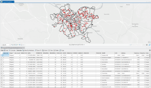
Chapter 9 Image
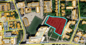
Chapter 7 Image
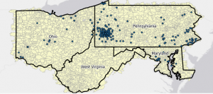
Chapter 8 Image