Month: October 2023
Coleman- Week 5
I also ran into issues with posting and copying images. I found it easier to write it on another document.
Mattox Week 6
Zip Codes: All zip codes in Delaware County from censuses, tax mailing addresses, and postal scrive websites.
Recorded Document: Points representing miscellaneous documents in Delaware, Ohio.
School District: School districts in Delaware county from parcel records.
Mapping Sheet: All of the areas in Delaware county clearly divided and showing each individual map sheet all together.
Farm Lot: Military service district farm lot boundaries.
Township: Boundaries of 19 different townships in Delaware county.
Street Centerline: Paved private and public roads.
Annexation: Conforming boundaries dating back to 1853.
Condo: Condominium polygon boundaries in Delaware.
Subdivision: All subdivisions and condos in Delaware.
Survey: Surveys represented as points similar to the recorded documents.
Dedicated ROW: Designated right-of-way lines.
Tax District: Tax districts within Delaware county.
GPS: GPS monuments between 1991 and 1997.
Original Township: Similar to township data.
Address Points: Central points on homes representing addresses.
Precinct: Voting from the Delaware County Board of Elections.
Hydrology: Major waterways.
Building Outline 2021: All structures in Delaware County outlined.
Parcel: All cadastral parcel lines within Delaware County.
PLSS: Public land survey system polygons in military survey districts.
2022 Leaf-on Imagery: I couldn’t see a map or information on this one.
Delaware County Contours: Contours showing elevation in Delaware County.
Delaware County E911 Data: Accident reporting points.

Pois Week 5
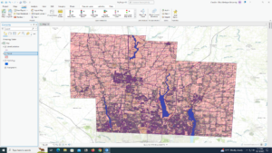
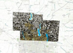
Same issue as before. Its not allowing me to insert my map photos properly, its either not there or incredibly blurry, so I have just included a pdf of the document I was working on for this content.
Pois Week 4
Its not allowing me to insert my map photos properly, its either not there or incredibly blurry, so I have just included a pdf of the document I was working on for this content.
Brokaw Week 6
Zip Code – All zip codes within Delaware, OH however roads with no zip codes were manually populated by their location.
Recorded Document – datasets contain points that are recorded documents in Delaware County. It was made to help find missing documents in the County.
School District – This set contains all school districts in Delaware County and was created for the Auditor’s parcel records.
Map Sheet – Contains the map sheet of Delaware County.
Farm Lot – All farm lots in the Virginia Military and US military for the Survey Districts.
Township – To identify the geographic boundaries of each township.
Street Centerline – The center of private and public roads. Used for 911 emergency response, appraisal mapping, accident reports, disaster management.
Annexation – All Delaware County annexations and conforming boundaries from 1853.
Condo – Dataset consists of condominiums polygons in Delaware County.
Subdivision – All subdivisions and condoms recorded in Delaware County Recorder’s office.
Survey – The survey points are a shapefile of a point coverage that represents all surveys of land. All surveys were scanned and saved as a pdf file.
Dedicated ROW – all dedicated road right of way polygons in Delaware County.
Tax Districts – Data set has all tax districts in Delaware County, Ohio.
GPS – identifies all GPS monuments set between 1991 and 1997 the Coordinates are in Universal Transverse Mercator Northing and Easting.
Original Township – all original boundaries of the townships before the tax district changed .
Address Points (DXF) – The State of Ohio Location Based Response Systems (LBRS) address points show a spatially accurate placement of address in a parcel.
Precinct – Polygons that determine each voting boundary.
Hydrology – all major waterways in Delaware County.
Building Outline 2021 – all building outlines of structures.
Parcel – all parcels in Delaware County.
PLSS – all polygons depicting the boundaries of 2 public military land survey districts.
Street Centerlines (DXF) – The State of Ohio LBRS street centerlines are the center [pavement of all private and public roads.
Address Point – The State of Ohio LBRS address points data are spatially accurate representation of all certified addresses.
2022 Leaf-On Imagery (SID file) – includes 2021 Imagery (SID file), Township, Original Township, and Recorded Document.
Delaware County Contours – 2018 2ft contours for the county is a geodatabase format.
Delaware County E911 Data – The layer can reverse geocode a set of coordinates to determine the closest valid address for 911 agencies.
Address Points – layer is intended to support appraisal mapping, and 911 Emergency Response.
Street Centerlines – layer is intended to support appraisal mapping, and 911 Emergency Response.
2021 Imagery (SID File) – contains 2022 Leaf-On-Imagery (SID file), zip code, recorded document, dedicated ROW.

Coleman Week 4
This week unfortunately was very on and off since I have been sick. I feel like I got through chapters 1,2 and 3 very successful. Chapter 4 was a little more hard. I had a few more maps, but their pdf form wouldn’t open for me in the end.
