Zip Codes: All zip codes in Delaware County from censuses, tax mailing addresses, and postal scrive websites.
Recorded Document: Points representing miscellaneous documents in Delaware, Ohio.
School District: School districts in Delaware county from parcel records.
Mapping Sheet: All of the areas in Delaware county clearly divided and showing each individual map sheet all together.
Farm Lot: Military service district farm lot boundaries.
Township: Boundaries of 19 different townships in Delaware county.
Street Centerline: Paved private and public roads.
Annexation: Conforming boundaries dating back to 1853.
Condo: Condominium polygon boundaries in Delaware.
Subdivision: All subdivisions and condos in Delaware.
Survey: Surveys represented as points similar to the recorded documents.
Dedicated ROW: Designated right-of-way lines.
Tax District: Tax districts within Delaware county.
GPS: GPS monuments between 1991 and 1997.
Original Township: Similar to township data.
Address Points: Central points on homes representing addresses.
Precinct: Voting from the Delaware County Board of Elections.
Hydrology: Major waterways.
Building Outline 2021: All structures in Delaware County outlined.
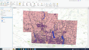
Parcel: All cadastral parcel lines within Delaware County.
PLSS: Public land survey system polygons in military survey districts.
2022 Leaf-on Imagery: I couldn’t see a map or information on this one.
Delaware County Contours: Contours showing elevation in Delaware County.
Delaware County E911 Data: Accident reporting points.