Chapter 7
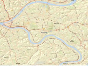
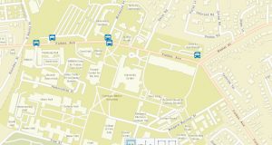
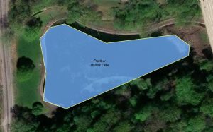
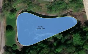
Chapter 7 introduced me to the process of manually digitizing features using various tools. I became more familiar with using basemaps throughout these lessons and learned how to edit and create vector map features. The tutorials were straightforward, allowing me to quickly grasp how to adjust polygons to align with building outlines by using the move, rotate, and resize tools. To achieve greater precision in aligning the polygons, I utilized the construction toolbar to add refined points, known as vertex points, to the corners of the buildings. Section 7.1 focused on the finer details of GIS work, helping me create polished maps at close range. In section 7.2, I gained valuable insights into symbolizing point features for parking lots and transportation locations on campus. However, the “Your Turn” exercise in section 7.2 posed some challenges, as the instructions did not clearly specify that I needed to change the feature class type to point. Additionally, I had difficulty locating the bus symbol and had to explore the symbology panel further to find the appropriate symbol. The next lesson guided me through editing polygon shapes and smoothing the green spaces. I practiced using the smooth polygon tool in the “Your Turn” section on Panther Hollow Lake. The final skill I learned was how to take a CAD layer and match it to the corresponding feature on the actual map.
Chapter 8
Chapter 8 focuses on geocoding, which is the process of matching addresses from the locator database to tabular data. I learned how to place points using this table data, but I also discovered that even a small mistake can result in inaccurate data points due to mismatches. To address the issues I encountered, I used the calculation tool in the attribute table menu, which provided valuable insights into the data. I practiced applying geocoding processes using zip codes, which helped me visualize how geocoding can effectively illustrate the concentration of a specific feature in a given area.
Chapter 9
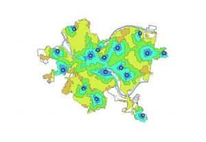
This chapter introduced me to various analytical methods that can be used for multiple purposes. The four methods covered are buffers, service areas, facility location models, and clustering. The buffer tool helps identify features within a specific radius. In lessons 9.1 and 9.2, I applied my knowledge of the pairwise buffer tool using data from 32 pools to estimate the number of children aged 5 to 17 living within a radius of 0.5 to 1.5 miles. Lesson 9.2 focused on teaching me how to use a multiple-ring buffer, which enhances the capabilities of the buffer tool. I learned that the purpose of the multiple-ring buffer is to focus on different features that fall within the specified distances of the buffered feature. Service areas are essential when I am working on a map that focuses on travel data.