Summary of Delaware county GIS data
Parcel
This data layer displays all individual properties as a polygon that can be selected. Displays polygon data and the corresponding information.
Address point
This data set aims to show the accurate point tied to each street address. The main use of this layer is to provide quick and accurate information to first responders.
Recorded document
An array of points that indicated recorded documents in the Delaware county record coming from each address. This was used to find miscellaneous documents.
Zip code
Separates Delaware county by zip code. In Delaware county there are 21 zip codes represented. Zip coders are used by counties to group addresses by geographic location.
School district
Roughly models similar polygons to zip code. Less School districts are present. School districts can be an important variable for parents moving to a new neighborhood in their decision to buy a home.
Map sheet
All map sheets in Delaware County. Not quite sure what a map sheet is but it seems to represent some form of geographic area.
PLSS(Public land Survey System)
Used by the US military and the Virginia Military service district of Delaware county. The internet said it is a public land use system for compensating Revolutionary war soldiers?
MSAG(Master street address guide)
Shows the 28 political jurisdictions found in Delaware county(ex: townships, cities, villages). Created to show boundaries and is most likely used in finding addresses and general geographic regions. I assume many of these boundaries cross into other counties.
Municipality
This seems to be something like a subset of the MSAG regions but this time I believe it is only showing those with defined corporation limits. Centered around areas of high development.
Farm lot
Shows data from the US military and Virginia military survey. All data is organized into farm plots even though not all the area is a farm plot. I believe they are ranked by percentage farmland based off of their FL_ID.
Township
Separates Delaware into its 19 different townships.
Street Centerline
Shows all major streets in Delaware. Useful for pathfinding and display of density of road systems. Smaller private roads do not seem to be present.
Annexation
Displays polygons that were individually annexed into Delaware counties and several municipalities. Includes date annexed.
Condo
Shows all condominiums located within Delaware county. Can be useful for mailing addresses as well as advertising campaigns that benefit from closely clumped groups of people.
Subdivision
Similar to above lists all subdivisions. Subdivisions are more common than condos here in Delaware county.
Dedicated ROW
Database of all roadlines indicated as right of way. Important in management of road infrastructure and calculating driving distances etc..
Precincts
Separates Delaware county into precincts.USed for voting and can be used by political analysts to identify causes of political background(ex: farmland, urban areas, often linked to political profiles)
Survey
Many individual data points. They indicate places where land surveys have been carried out.
Tax district
Separates Delaware into task districts. Similar to other boundaries that have been drawn around the city/township.
Building outline
Outlines all buildings as of 2024. Very defined polygon drawings that can indicate house shape and size. High number of individual polygons. Shape area and length can be important here in studies done on this value.
Railroads
Indicates railroads. Can be an important factor in determining living areas because of noise issues. Construction companies might choose to build elsewhere based on close proximity to railroads.
Delaware county E911 Data
Used by emergency response units to find individual house centroids and make decisions on things like emergency response placement, and locating emergency addresses.
Building outline data 2021
Same as above (2023, 2024)
Hydrology
All major waterbodies. Includes the 4 large lakes and some smaller reservoirs and some rivers of a certain size or larger. Includes area and is an important layer for those concerned with available drinking water, recreation, etc.
GPS
Pairs of centroids located nearby to each other vary in distance. Each represents a GPS monument. All were established in 1991 or 1997.
Delaware county contours
Shows the contours of Delaware County. Contours are represented by 2 foot increase and decrease.
Original township
Shows original township location. Includes name and acreage. Does not include for what period these townships existed.
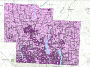 This is a map containing the layers parcel, Street Centerline, and Hydrology.