Week 8:
Parcel: This dataset shows all cadastral parcel lines within Delaware County as polygons. This data is maintained by the Auditor’s CAMA and published monthly.
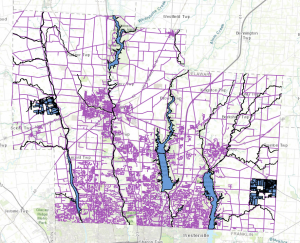
Street Centerline: This dataset shows street centerlines that are on pavement in public and private roads throughout Delaware County. This is gained by observing address locations as well as adding addresses from permit information. All of these points are collected to create this map through the connection of the lines/streets.
Condo: This dataset shows each condo that is in Delaware County by using polygons just like in the parcel dataset.
Subdivision: This dataset shows all the condos and subdivisions that are seen in Delaware County. We can see from this map that there are a lot of subdivisions.
Address Points – DXF: This dataset is used to accurately place addresses within their given area in Delaware County. With this data, we can see the exact places where these addresses are.
Street Centerlines – DXF: This dataset is used to show the streetlines on Delaware County’s public and private roads. Just like the street centerline above.
Zipcodes: This dataset shows all of the ZIP codes within Delaware County. Through the different areas on the map were are able to see the different zip codes from the boundary lines. These ZIP codes were based on USPS and the Census Bureau’s ZIP code files.
School Districts: This dataset consists of all School Districts within Delaware County. From the map, we can see that there are 23 districts in Delaware County.
Building Outline 2023: This dataset shows every single building in Delaware County. On the map, when you zoom in, we see a blue cover on every single building outline, which just shows how many there are.
Building Outline 2021: This dataset is the same as above.
PLSS: This dataset shows us how many Public Land Survey Systems there are in Delaware County. We see this through polygons that represent both US Military and the Virginia Military Survey District. Through this data, we can see that there are 134 in Delaware County.
Township: This dataset shows the different townships that are in Delaware County. Through this data, we can see that there are 60 in Delaware County.
Delaware County E911 Data: This dataset uses spatially accurate address points within Delaware County. It helps show appraisal mapping, 911 emergency responses, accident reporting, geocoding, and disaster management in each spot in Delaware County.
Original Township: This dataset shows the different townships that are within Delaware County. From this data, we can see that there are 18 in Delaware County.
Recorded Document: This dataset shows recorded documents in the Delaware County Recorder’s Plat Books, Cabinet/Slides, and Instruments Records, which are not represented by subdivision plats that are active. These are documented as vacations, subdivisions, centerline surveys, surveys, annexations, and miscellaneous documents within Delaware. From the map, we can see that there are 1,242.
Dedicated ROW: This dataset shows all lines that are designated Right-of-Way within Delaware County. With the data being line data, it is created daily. From the map, we can see that there are 1,335 in Delaware County.
Precincts: This dataset shows the number of voting precincts in Delaware County. From the map, we can see that there are 180 in Delaware County.
Delaware County Contours: This dataset shows 2018 Two Foot Contours as well as 2018 Two Foot Contours for Delaware County.
Building Outlines – DXF: This dataset is used to see the building outlines of all the buildings in Delaware County.
Address Points: This dataset is used to accurately place addresses within their given area in Delaware County. With this data, we can see the exact locations of these addresses.
Map Sheet: This dataset is used to show all the map sheets in Delaware County. From the map, we can see that there are 360 in Delaware County.
Farm lot: This dataset is used to show all the farm lots in both the US Military and the Virginia Military Survey District. From this, we can see the boundaries in both of these areas. From the map, we can see that there are 2,077 plots in Delaware County.
Annexation: This dataset is used to show all of the annexations and conforming boundaries from 1853 to the present in Delaware County. From the map, we can see that there are 446 in Delaware County.
Survey: This dataset is used to show survey points in a shapefile of point coverage that represents surveys of land within Delaware County. From the map, we can see that there are 18,097 in Delaware County.
Tax District: This dataset is used to show all tax districts within Delaware County. From the map, we can see that there are 66 districts in Delaware County.
Hydrology: This dataset is used to show all major waterways within Delaware County. From this map, we can see that there are 24 major water sources in Delaware County.
GPS: This dataset shows all GPS monuments that were established in 1991 and 1997. From this map, we can see that there are 351 GPS monuments in Delaware County.