Throughout this week’s tutorials, I feel like we have been looking at how some of the concepts described in the book apply in the software. For example, we were able to see the randomly placed discrete data points that GIS makes from continuous data. Also throughout the tutorials, we learned how to use lots more of the tools, and we were often doing joins, which still don’t make a lot of sense to me on how they are constructed, though conceptually I understand the output.
Chapter 4
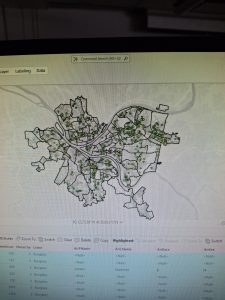
Chapter 4 mostly looked at how to manipulate data into getting specific findings. It also was a great demonstration of how to get rid of overcrowded data, which was also strongly emphasized in the esri textbook. We worked a lot with the select by attributes tool to do these clean ups. I did not have many issues during this section, but it was, at times, difficult to find saved files. Throughout this while tutorial, actually, that was a big issue. I will save and unzip files to a specific location, and when I look for them to open in ArcGIS, they are gone, and sometimes completely somewhere else (maybe from a previous person that accidentally saved them to the desktop). Below is an example of a map simplified by select by attributes.
Chapter 5
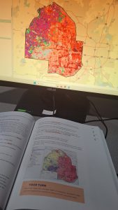
We explored different types of maps from different sources throughout this chapter. This chapter, out of all of them, was the most out of date. It was extremely frustrating and I was not able to complete a pretty good portion of it due to this. Part of it was files getting lost, as I mentioned before, and the other part was that many things the book was telling me to retrieve or fill in were no longer existent/the same. I was specifically not able to figure out how to fill out the join table here, as the directions had me putting in things that weren’t even in the data set, or maybe I had done something wrong way way prior, I am not sure. I redid it a couple of times and still got stuck. Below is an example of an inconsistency that was a bit less important …visually, but the names attached to the colors in the book were text, and they were vague numbers in the program. Luckily there was not much to do with them.
Chapter 6
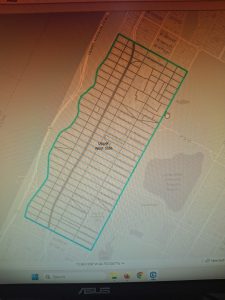
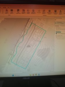
Chapter 6 was another that explored cleaning data up, as the esri book emphasized. We did lots more joins, and I started to get more used to using the tool, but I am not sure how all of this will go when I do not have a book taking me step by step. We also clipped streets to include only the amounts that were within borders, not including the lengths that stretched outside. Below, that is shown.
Overall very frustrating group of chapters, but I suppose that is how you learn.