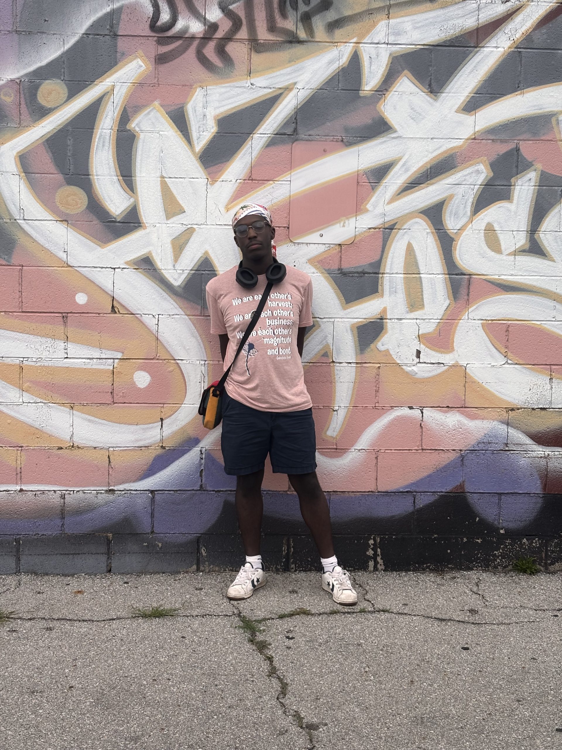
*I have completed the GEOG 291 Quiz for Week1*
My name is Tomorick Hutto. I am a junior here at OWU, and I am majoring in Politics and Government with a minor in Religion. I chose to enroll in GEOG 291 after becoming interested in a career in urban and regional planning, specifically when it comes to mapping transportation accessibility and seeing how many internships and careers in the field rely on GIS, so taking this course is more of a way for me to build a technical skill that I can use later rather than just taking a course to fulfill a degree requirement.
After reading Schuurman Ch.1, I found myself to have a better grasp and understanding of what GISystems and GIScience are, the multiple identities the acronym encompasses, as well as how GIS has been used and can be used in each of our daily lives. Prior to reading this chapter, I had a relatively vague understanding of what GIS was and its uses; I knew that planning commissions and other state and local government agencies used GIS software within the planning process to see residential, commercial, and industrial zones and how proposed developments could affect each of those zones and surrounding communities, however, I was not familiar with the uses of GIS software, at least when it came to other private firms such as Starbucks and Sanitation/Dumpster companies as well as even the defining role Geographers and university researchers played in part of developing and utilizing GIS software.
One of the points I found most interesting throughout the Chapter was when Schuurman brought up how GIScientists study the underlying theories and concepts of what makes GISystems, and even how GIScientists have studied questions about whether GIS software and other technological tools that have been developed for similar uses are inherently gendered, which is a question that I had not even considered prior to reading this chapter.
Another part of the chapter that I found particularly interesting was when Schuurman touched on the significance of the implementation of e-governance by various federal and provincial governments throughout the world and how e-governance technologies have been used to share information with the public in a much transparent manner which includes allowing private firms to access tax assessment information, survey lines, and other useful public definitions, which can be useful as a means to reduce high levels of corruption in different governments, however, I do also find the arguments of potential data privacy concerns thought provoking and whether there are better alternative methods to address privacy concerns while also still being able to relay important data which has been proven useful for people in various disciplines.
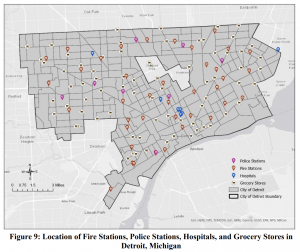
Source 1: Osei, Ernestina, “Identifying Socio-Economic Areas of Concern Towards Inclusion in GIS Hazard Management in Detroit, Michigan.” (2026). Master’s Theses or Doctor of Nursing Practice. 3306. DOI: 10.58809/CSVU1038 Available at: https://scholars.fhsu.edu/theses/3306
Figure 9 shows the locations of Fire stations, Police stations, Hospitals, and Grocery stores in Detroit. I found Figure 9 interesting since this particular study examines the spatial distribution of socio-economic vulnerability and accessibility to essential services in Detroit and highlights that when Hazards or other weather crises strike, the lack of grocery stores in parts of Detroit where there could be potential food deserts, make those with lower incomes more susceptible to exposure and sensitive to environmental hazards due to traveling to the grocery store with the proper needs.
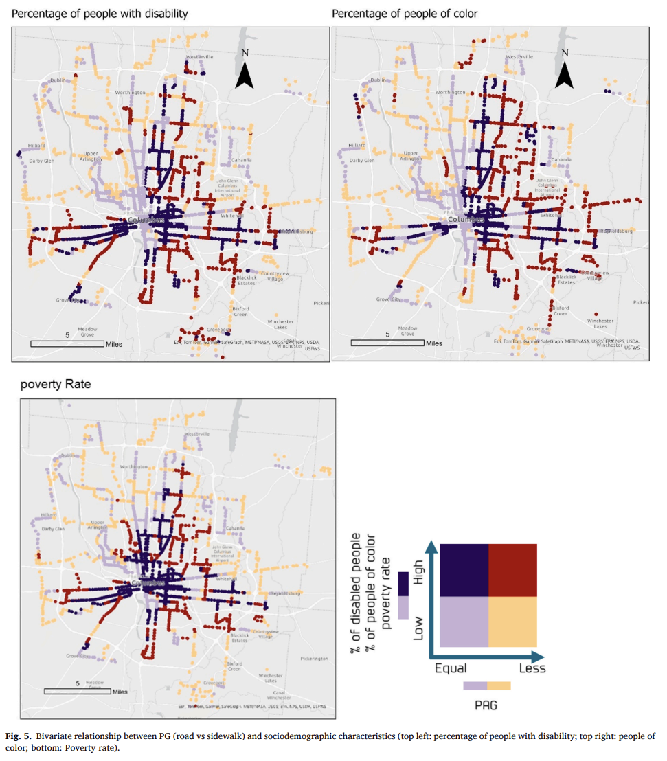
The above map was interesting to me because it uses a Ped shed Gap measurement; basically a way of showing where people can or cannot walk to essential places and then compares that with the percentage of people of color and those with disabilities. I’ve never seen a map like this before until now and it took me looking at the map more closely as well as the description within the study, which measures the impacts of sidewalks on public transit and accessibility, to understand the relationships better.
Source 2: https://doi.org/10.1016/j.trip.2025.101576