Chapter Four Notes:
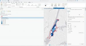
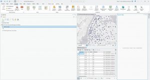
Chapter Four was a fairly difficult chapter to complete, introducing concepts from the previous three chapters along with a tutorial on how to create your own project. I found creating my own project to be fairly difficult to begin with, as the other tutorials are all provided for the reader. However, by Tutorial 4-2, I felt far more confident with creating my own basemap and project and importing the data provided. Unlike the Chapter Three tutorial, where the reader was generally provided with copy-and-paste data, in Chapter Four, there was far less guidance on a new subject. The rest of Chapter Four mainly dealt with becoming comfortable and familiar with ArcGIS as a software, especially in terms of familiarity. In Tutorial 3-3, oddly, when calculating specific burglaries by different filters, the burglaries were off in terms of count. The textbook lists the count of burglaries as 273, with 84 occurring on the weekend. However, my count ended up as 309, with 75 occurring on the weekends. This was after I double-checked my search query for the correct date and crime. Further, the query person attributes had inaccurate values displayed. Otherwise, Chapter Four relatively followed the textbook, and I had to make no major adjustments to the commands provided in order to complete the work in the textbook.
Key Commands and Concepts Taught In This Chapter:
- Add join: Joins two datasets together, merging data tables to be able to complete or calculate fields in relation to both tables and data sets
- Create table: Uses pre-existing map data and condenses it into an easily editable format for further data analysis and manipulation
- Calculating the sums of fields: adding, subtracting, etc to different data sets in order to calculate a percentage or other form of data presentation. Relies on basic Python script
Chapter Five Notes:
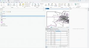
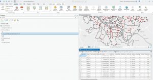
Chapter Five took me the longest amount of time and outside research due to inaccuracies in the textbook that make following the textbook directly impossible. Tutorial 5-1 through Tutorial 5-3 were fairly straightforward, and only took me about ten minutes each to complete. Much of the first half of Chapter 5’s tutorials are reviewing key concepts covered in previous chapters, and only take a few commands to complete. Additionally, this first part of the tutorial teaches incredibly vital map skills, which I went back to review multiple times in the following tutorials and also within completing the tutorials for Chapter 6. Tutorial 5-5 was very different from what I was used to in the preceding tutorials and chapters, as I have never worked with Microsoft Excel or other similar programs such as Google Sheets. Editing the data was fairly straightforward, and I found that highlighting the columns that I needed to avoid deleting in red text made it much easier to not lose the columns in the rest of the data set. Further on in this tutorial, I found that the command provided to join together the MinnesotaTracts and BikeWorkData tables were very incorrect. The GEOID and GEOIDNUM fields both registered as incorrect when placed in the Input and Join Table fields, and were instead placed in the order: MinnesotaTracts > GEOID > BikeWorkData > GEOIDNUM. As completing the Add Join function was vital to the rest of the tutorial, adjusting the command was necessary. In the next chapter, the tutorial erroneously lists the basemap used, which took some adjustment and guessing in order to accomplish.
Key Commands and Concepts Taught In This Chapter:
- (For my own further review) The pathway to change the map projection for a basemap is: Contents > Properties > Coordinate System > Projected Coordinate System. This contains multiple world, US State, and country projections.
Chapter Six Notes:
After many major adjustments to Chapter Five’s listed commands, I was relieved to find that Chapter Six had no major errors unlike the previous two chapters. Whether the outdated version or some other factor, the previous chapters very much tested my computer knowledge! Chapter 6, notably, uses far less descriptive wording than the introductory chapters, which was initially a bit of adjustment in remembering how to execute certain commands without express guidance from the textbook. For example, in the very first tutorial, the textbook asks the reader to label the New York fire stations by district. Initially, I forgot which commands were required in order to label a certain area, and I had to repeatedly undo actions I took until I was able to review and correctly label the map. Additionally, a previously introduced feature which I had some difficulty remembering how to execute was the Select tool. It took me multiple tries to realize selecting a certain feature was just clicking, not necessarily dragging the cursor over an area, which selected too many attributes. Then, while saving the selected section was not reviewed, I was able to parse out what function was required in order to save a selected area. Most of the tutorials in this chapter dealt with learning what to input for certain commands, especially key commands used frequently throughout the textbook.
Key Commands and Concepts Taught In This Chapter:
- Merge tool: merges multiple datasets into one feature that is easier to edit and symbolize, for example, merging together all portions/neighborhoods of New York City to create a comprehensive map of all of New York City.
- Tabulate Intersection: estimates the number of people within two boundaries, shown in the textbook as census boundaries and fire station districts.