I completed the GEOG 291 quiz.
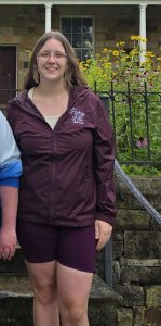
My name is Kylie Redman. I am a junior from Richwood, OH studying Zoology. I took this class to gain a better understanding of GIS and its purpose. I think that taking this class will help me to gain a better understanding of conservation and how I can have an impact in my career of working with animals.
Before I read this chapter, I did not know how widespread GIS was or that it was of any significance. I thought that it was just a map. I now know that in addition to being a map, it also involves the analysis of maps, and includes many different uses.
One surprising thing about GIS is that the topic struggles to have a distinct identity with just one use, as it can be used in two completely different ways. The first way that GIS can be used is as a software tool. Municipalities and local government organizations use GIS mainly as a software program. It is used to map out exact lines of properties and urban zones, organize databases, and analyze the effect of building a road along a new route. In a more scientific approach, researchers, scientists, and university professors use GIS to solve complex theoretical equations. This can include drawing clear boundaries on maps, and the tracking of disease spread. The Author makes it a point to make a distinction between mapping versus spatial analysis in GIS. Simple mapping displays spatial geographic data, while spatial analysis involves using multiple data layers to develop new information that is not shown on a regular map.
This chapter reviews the history of GIS in the development from basic computer maps to the modern spatial analysis tool. The history section includes landscape architect Ian McHarg, who invented the technique for map layers to route highways. Early computer Cartography, and pioneering systems were also involved in the history of GIS.
In the latter part of this chapter, challenges are discussed. In order to add geographic features into a computer, there needs to be sharp boundary lines, which can be difficult as many borders of cities and towns do not have distinct boundaries. Date models, categorization, visualization, and scale were also shown to be challenges.
In all, GIS is so much more than just a tool to navigate to a new city. GIS is very important for spatial analysis to solve complex problems.
Application 1: highways cutting through habitats of animals frequently result in heightened animal mortality rates. To address this rising issue, researchers used GIS to integrate tracking data from bears, bobcats, fishers(small mammal) to design a road system that involves strategically places underpasses and overpasses to reduce animal fatality.
Application 2: When creating nature reserves, standard borders often fail to cover the full areas where endangered plants and animals actually live. To fix this, conservation scientists use GIS to combine field sightings with environmental data like climate, terrain, and soil type. GIS combines all of these to map habits of all three species to help scientists protect wildlife while also benefiting land needs for people.
T
These maps show the calculated minimum cost-distance habitat linkages for a) black bear, b) bobcat, and c) fisher. the three images were merged to form the functional habitat linkage (image 4)
Source: Geo Contributor. (2024, August 12). How GIS is Being Used in Conservation Biology. Geography Realm.