*I have completed the GEOG 291 quiz and reviewed the syllabus*
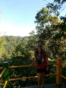
My name is Brittney Parks and I am a senior at OWU. I am majoring in zoology and botany, with a minor in philosophy. I am planning to pursue a PhD. after I graduate this spring. On campus I am the secretary of the Women in STEM club and fundraising chair for the Women’s Rugby club. I have also been doing research with Dr. Gangloff for three years. I am hoping that being able to learn GIS will help me have a more diverse set of skills to assist me in my future research.
Admittedly, I knew very little about GIS when I selected this course, I had just been told it would be a good skill to have. After reading this chapter I feel like I have a much better understanding of what GIS is. I had always just thought of GIS as an environmental science thing, so it was interesting reading about all of the interesting applications for GIS. I found it especially interesting that it can be used for researching the spread of infectious diseases and archeology. The example of John Snow’s application of visual intuition mapping to study the Cholera outbreak (Page 13) reminded me of how GIS could be used to study infectious diseases. I hadn’t considered that GIS could be applied to situations like that.
This reading helped me understand the concepts and details of GIS better. The author discusses the difference between mapping, which is visually displaying geographic information, and spatial imaging, which generates information using geographic information. I was previously unaware of the different definitions of GIS, geographic information science (GIScience) and geographic information system (GISystem), but I think the reading did a good job of explaining it. To my understanding, GISystem is the development of tools and processes to analyze spatial data and GIScience is studying the theories and concepts related to spatial data. The author described it as “GIScience is the theoretical basis for GISystems” (Page 11). It was also interesting to read about the debate and discourse occurring within the GIS field. They are still trying to figure out how to define boundaries and categories for spatial entities. I found the examples of the boundary between the mountains and the foothill and the categorization of mountain elevation levels to be helpful in understanding this. Learning about how there is still debate within the field really highlights how it is still an actively growing and developing field.
Application 1:
In this study, they used GIS to map out the presence of a viper species in the Iberian Peninsula in comparison to the suitability of the habitat in the area. Applications like this can be very important for wildlife conservation research.
Habitat suitability map is shown below.
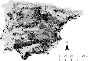
Santos, X., Brito, J. C., Sillero, N., Pleguezuelos, J. M., Llorente, G. A., Fahd, S., & Parellada, X. (2006). Inferring habitat-suitability areas with ecological modelling techniques and GIS: A contribution to assess the conservation status of Vipera latastei. Biological Conservation, 130(3), 416–425. https://doi.org/10.1016/j.biocon.2006.01.003
Application 2:
In this study, they used GIS to look at soil moisture across part of India and how it affects the agricultural capabilities in the area. Applications like this can be very important for fulfilling agricultural needs with the increase in drought conditions.
Soil moisture in the study area is shown below.
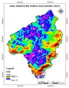
Saha, A., Patil, M., Goyal, V. C., & Rathore, D. S. (2019). Assessment and Impact of Soil Moisture Index in Agricultural Drought Estimation Using Remote Sensing and GIS Techniques. Proceedings, 7(1), 2. https://doi.org/10.3390/ECWS-3-05802