Finished GEOG 291 Quiz!!
Hello! I am Talia Jefferson. I am a sophomore and am majoring in Environmental Science. I love getting outside, taking walks, and watching different shows.
Before reading Schuurman ch. 1 I was not aware of what GIS was/is. It was a term that I heard a lot last year and yet I never took the time to understand what it meant. When I have thought of GIS, my first thoughts were mapping, and now I know that is only a tiny part of what GIS does. GIS began as a way for a landscape architect to make the most optimal route for a new highway. It began as a need for innovation and then eventually evolved.
I realized while reading I had heard the term GIS in National Geographic docs. I remember in the vidoes, GIS was used to reconstruct a visual of what land in an area looked like hundreds to thousand years ago. I always found this very interesting and a good use of tech. The visual reconstruction made it so the scientists could start to understand ancient life and practices to enhance our historical knowledge. It is always important to learn and understand the past, especially the parts of ancient history that is still left widely unknown. But this is not the only good GIS can do. The article mentioned GIS success in health, agriculture, development etc…
Gis is used to map an area to then analyze spatial data within location and other descriptions. Which is then used to for urban planning, tracking natural disasters/climate, used for businesses, resource management…all things that are important to help society function efficiently. Before reading this article I did not understand the importance of GIS. It was merely a word I heard from time to time and one I never put my thought into. Now I can appreciate the full extent of GIS and the science behind it while also learning how to use it in this class.
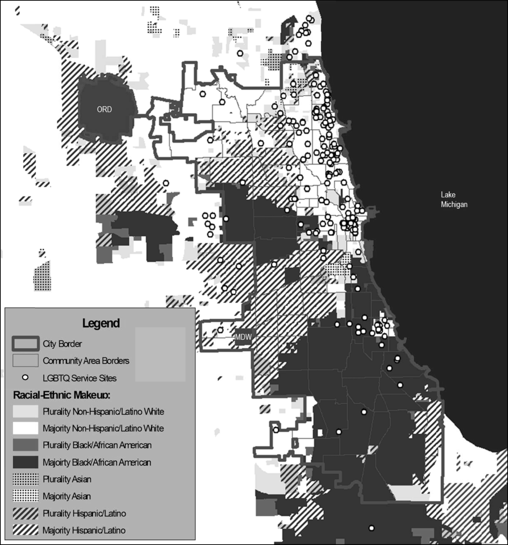
This image represents three main areas that show the analysis of the spatial context of the services for LQBGTIA people that were disproportionately located in areas with less people of color and underrepresented in Black/African American and Hispanic/Latino groups.
Chicago LGBTQ service sites and race/ethnicity. Racial/ethnic data is based on the 2011–2015 American Community Survey estimates and presented at the block group level. ORD, O’Hare International Airport; MDW, Midway International Airport
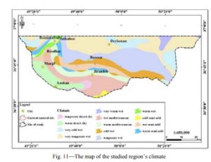
This image is a map of the climate in norther Iran. The purpose of the map is to plan for planting and restoration of the endangered lily in the northern part of Iran. More maps were preparied that then were overlaid in GIS software to separate suitable regions for planting vs non-suitable regions for planting. It was found that 19 suitable regions were compatible with the site condition of the species were queried in the GIS.