Rose-Final Week

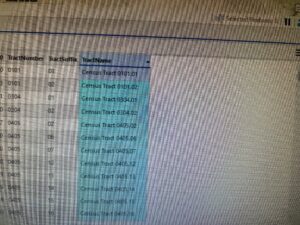
Delaware Data Inventory

  • Address Point: Representation of all certified address within Delaware County Auditor’s GIS Office
  • Annexation: Contains Delaware County’s annexations and conforming boundaries from 1853 to present
  • Building Outline: Consists of building outlines for all structures in Delaware County, Ohio
  • Condo: Consists of all condominium polygons within Delaware County, Ohio that have been recorded
  • Dedicated ROW: Consists of all lines that are designated Right-of-Way within Delaware County, Ohio
  • Delaware County Contours: 2018 Two Foot Contours
  • Delaware County E911 Data: Spatially accurate representation of all certified address within Delaware County
  • Farm Lot: Consists of all the farm lots in both the US Military and the Virginia Military Survey Districts of Delaware County
  • GPS: Identifies all GPS monuments that were established in 1991 and 1997
  • Hydrology: Consists of major waterways in Delaware County, Ohio
  • MSAG: The Master Street Address Guide polygon feature set of the 28 different political jurisdictions such as townships, cities, and the villages that make up Delaware County
  • Map Sheet: Consists of all map sheets within Delaware County
  • Municipality: Consists of all municipalities within Delaware County
  • Original Township: Consists of the original boundaries of the townships in Delaware County before tax district changes affected their shapes
  • PLSS: Consists of all the Public Land Survey System polygons in both the US Military and the Virginia Military Survey Districts of Delaware County
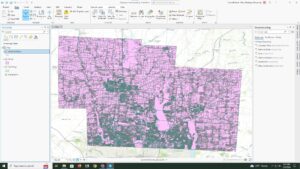
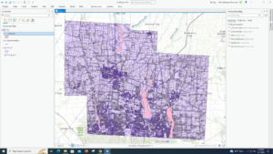
  • Parcel: Consists of polygons that represent all cadastral parcel lines within Delaware County
  • Precinct: Consists of Voting Precincts within Delaware County
  • Recorded Document: Consists of points that represent record documents in the Delaware County Recorder’s Plat Books, Cabinet/Slides and Instrument Records
  • School District: Consists of all School District within Delaware County
  • Street Centerline: The State of Ohio Location Based Response System Street_Centerlines depict center of pavement of public and private roads within Delaware County
  • Subdivision: Consists of all subdivisions and condos recorded in the Delaware County Recorder’s office
  • Survey:  Survey Points is a shapefile of a point coverage that represents surveys of land within Delaware County
  • Tax District: Consists of all tax districts within Delaware County
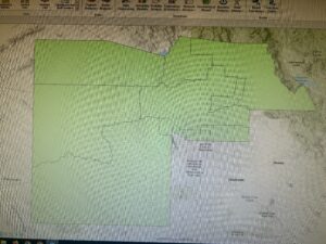
  • Township :Consists of 19 different townships that make up Delaware County
  • Zip Code: Contains all zip codes within Delaware County

Miller Week 6

9.1 – Learned how to use the pairwise buffer tool. Was able to figure out all the steps but adding a new buffer on top of a previous buffer.
9.2 – Was able to create multiple ring buffers, which would have been useful for the last step in the previous section.
9.3 – Was somehow not able to find the excel work. Overall, quite a long section, but slow and careful work made the entire section go smoothly for the most part.
9.4 – Used the network analysis to connect certain features to facilities. This section was short and mostly simplistic.
9.5 – Was able to perform a cluster analysis with previously given data. A simple section that yielded the proper results.
10.1 – Did a lot of work using raster datasets. Although the actual reasoning behind using these tools made no sense, I was still able to follow all the directions.
10.2 – Was able to make a kernel density heat map with the use of multiple tools. The end product was quite cool.
10.3 – Learned how to build a risk index model. This section was quite long, but I was able to figure out most of the steps. I was not able to find the PovertyIndex.lyrx file, so I was not able to finish that part of the section.
11.1 – Started diving into using 3D GIS, in which I learned the basic tools to navigate the system.
11.2 – Worked with creating and editing TIN surfaces. Another cool process, in which the steps made sense to me.
11.3 – Was able to add z-enabled features, which were 3D models of specific points on the map. Overall, it was neat to see the final result.
11.4 – This section was quite long and took a decent amount of work to do. I was able to get through all the steps but the bridge steps did not work. The bridge option was not available in the create features pane.
11.5 – Was able to work with 3D features, such as creating stories within buildings, and altering building heights. Overall, this was an easy tutorial.
11.6 – This section also worked with modifying buildings from a 3D model. All the parts of this tutorial worked for me but the last section, despite the steps being simplistic.
11.7 – Was able to work with creating and editing an animation using bookmarks. Overall, a very cool process that I did not know was possible. I was not able to export the animation, as the export time was somehow quite long.

Miller Week 5

4.1 – Figured out different ways of importing and to move data on GIS pro. I was not unable to figure out how to set up a folder connection, but the rest of the steps made sense.
4.2 – I was able to learn more information about modifying attribute tables, along with using the fields view. All the steps made sense, but the expression with the population under 20 was not showing up.
4.3 – Was able to work more with the attribute queries, as I was able to narrow down the specific data. It was really cool to narrow down the crime data to one individual.
4.4 – A relatively quick and easy chapter. Continued to mess with attribute tables, and reused some steps from the first part of the book.
4.5 – Continued to learn new items for the tool box. I was once again able to mess with the symbology tool as well.
4.6 – Another short chapter, I was able to work more with attribute tables. I was not able to figure out how to make a one-to-many join section.
5.1 – Was able to figure out how to change the type of world map. Pretty easy to understand.
5.2 – Pretty much the same concept as 5.1, but working with US maps.
5.3 – Worked on adding new layers to a given coordinate system, along with changing coordinate systems. Overall a cool process.
5.4 – Was able to figure out the vector data donat section, which was similar to 5.3. I need to relearn working with the symbology a bit more.
5.5 – This section was quite complicated and took a while to figure out. I was unable to find/import the three consensus shape files, which limited me for doing the rest of the section.
5.6 – I am not going to lie, none of this section worked for me. I think I am running into the problem that the data is not downloading to the proper source, in which I am not able to complete the section.
6.1 – I was able to dissolve certain features to show smaller neighborhoods. This section made sense and was easy to follow.
6.2 – I knew what this section wanted me to do, which was to combine the neighborhood and the streets within the given neighborhood. However, the directions were quite confusing, and I was not able to get the final product.
6.3 – Quite an easy process of using the merge tool to merge water features.
6.4 – Really did not understand the purpose of the append tool. However, the directions were fairly simple, as it seemed like I added more specific data to the attribute table.
6.5 – Was able to intersect features to help figure out the fire zones. The overall process was easy to follow.
6.6 – Was able to summarize certain values in neighborhoods in the Brooklyn area, which was quite interesting. Finally figured out how to use the join tables tool.
6.7 – Another straightforward section. Was able to use the tabulate intersection tool to compare numbers of disabled people in different fire zones.
7.1 – Was able to mess with editing polygons, whether it was changing their shape, or splitting them. Overall an easy and cool section.
7.2 – Also a very easy section to understand. I was successfully able to create and delete certain polygons.
7.3 – The smooth polygon tool is not only easy, but very satisfying to use.
7.4 – This section focused on transforming polygons. It took a lot of steps to accomplish this, but I did get the right result.
8.1 – Started the basics on geocoding, which mainly uses zip codes as data. The overall process was fairly easy to follow.
8.2 – Did more geocoding, but with street addresses instead. Also a straightforward section.

Gassert, week 6

Ch. 9


9.1: A buffer here is defined/represented as a polygon in surrounding map features in a feature class. There is usually a specified radius. You have to use the pairwise buffer tool to create the buffer data.


9.2: Use multiple ring buffer tool to configure polygons. Use the “spatial join tool” to utilize the spatial overlay for statistics. 


9.3: This was complicated and I believe I messed something up. It gave me an error and when I went back to try and fix it, it wouldn’t load.


9.4: This one was also weird to me, as I believe whatever I did wrong in 9.3 got me backwards.


9.5: Got back into the correct lane for this part (I think). I feel the “your turn” part could’ve had a little bit more guidance.


Ch. 10


10.1: Used the raster layers for attributes. This shows things like precipitation and land topography. This sort of map looks vaguely familiar to me and it was easy to use.


10.2: There was a little bit of discrepancy here with the tools I was suppose pd to use, but I figured it out. The KDS thing for smoothing data was easy to use and learn because it’s pretty flexible.


10.3: Another part with a “your turn” section. The book doesn’t really give a whole lot of pointers and useful images to know what you’re doing. I felt what I did was at least half complete.


Ch. 11


11.1: After 3D stuff sparing to work in the past, this one actually loaded! These tutorials were a little easier to follow along with since the visuals weren’t too convoluted.


11.2: Pretty linear, showed me local elevation data. This data looks pretty precise.


11.3: Adding stuff was actually pretty fun. You can do this by specifying z values.


11.4: There were a lot of parts to this that seemed off with the book. This part was hard for me to understand.


11.5: This was a little like 11.3, but with more to it. This showed you how to edit buildings to have more floors to make them more accurate in 3D. You use the duplicate vertical tool to do this.


11.6: This part, you need the CityEngine rule package file (listed as .rpk) to have all the assets to do this. It has the textures and 3D models included. 


11.7: This part was super laggy and late to load things in. The tool you use for the animation is in the view tab under the animation group (which makes sense).  


Howard Week 7

Available Data Date Summary for Delaware County GIS Files

Zip Code Map Data Layer- Contains all zip codes within the county, originally created in the early 2000’s but updated regularly and published monthly. Also includes the information used to populate both the zip_right and zip_left attributes for the county’s road centerline data.

Recorded Documents Data Layer- represent documents like vacations, subdivisions, centerline surveys, annexations, and other misc documents within in county recorder’s plat books, cabinet/slides and instruments records.

School District- this shows all the school districts within the county.

Precinct- consists of polygons showing the boundaries of each voting precinct boundary in the county.

Building outlines- has the outlines of all buildings in Delaware.

Original township- Consists of the original township boundaries in the county before tax district changes affected their original shape

E911 Data- is a spatially accurate representation of all certified addresses in the county, used for location, 911 emergency response, accident reporting, geocoding, and disaster management.

Township- data set that consists of the 19 townships in the county.

PLSS-consists of all Public Land Survey System polygons in the US Military and Virginia Military Survey Districts of the county.

Delaware County Contours- consists of 2 foot contours in 2018.

Street Centerlines- depict pavement centers of all public and private roads in the county, from the State of Ohio Location Based Response System.

Parcel- consists of polygons representing all cadastral parcel lines within the county.

Address Points- provides a spatially accurate placement of addresses within a parcel in the county, meant for 911 emergency response, support of appraisal mapping, accident reporting, geocoding, and disaster management.

Subdivision- consists of all condos and subdivisions recorded in the county.

Condo- consists of all condominium polygons recorded in the county.

Hydrology- consists of all major waterways within the county, enhanced by Lidar-based data in 2018.

Tax District- consists of all tax districts within the county, defined by the county’s auditor’s real estate office.

Dedicated ROW- consists of all lines that are designated as right-of-way within the county.

GPS- identifies all GPS monuments created in 1991 and 1997 in the county.

Survey- is a shapefile consisting of point coverage that represents surveys of land within the county

Map Sheet- consists of all map sheets within Delaware county.

Annexation- contains all annexations of conforming boundaries from 1853 to present day within the county.

Farm Lot- consists of all farmlots and their boundaries in the US Military and Virginia Military Survey Districts of the county.