Available Data Date Summary for Delaware County GIS Files
Zip Code Map Data Layer- Contains all zip codes within the county, originally created in the early 2000’s but updated regularly and published monthly. Also includes the information used to populate both the zip_right and zip_left attributes for the county’s road centerline data.
Recorded Documents Data Layer- represent documents like vacations, subdivisions, centerline surveys, annexations, and other misc documents within in county recorder’s plat books, cabinet/slides and instruments records.
School District- this shows all the school districts within the county.
Precinct- consists of polygons showing the boundaries of each voting precinct boundary in the county.
Building outlines- has the outlines of all buildings in Delaware.
Original township- Consists of the original township boundaries in the county before tax district changes affected their original shape
E911 Data- is a spatially accurate representation of all certified addresses in the county, used for location, 911 emergency response, accident reporting, geocoding, and disaster management.
Township- data set that consists of the 19 townships in the county.
PLSS-consists of all Public Land Survey System polygons in the US Military and Virginia Military Survey Districts of the county.
Delaware County Contours- consists of 2 foot contours in 2018.
Street Centerlines- depict pavement centers of all public and private roads in the county, from the State of Ohio Location Based Response System.
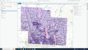
Parcel- consists of polygons representing all cadastral parcel lines within the county.
Address Points- provides a spatially accurate placement of addresses within a parcel in the county, meant for 911 emergency response, support of appraisal mapping, accident reporting, geocoding, and disaster management.
Subdivision- consists of all condos and subdivisions recorded in the county.
Condo- consists of all condominium polygons recorded in the county.
Hydrology- consists of all major waterways within the county, enhanced by Lidar-based data in 2018.
Tax District- consists of all tax districts within the county, defined by the county’s auditor’s real estate office.
Dedicated ROW- consists of all lines that are designated as right-of-way within the county.
GPS- identifies all GPS monuments created in 1991 and 1997 in the county.
Survey- is a shapefile consisting of point coverage that represents surveys of land within the county
Map Sheet- consists of all map sheets within Delaware county.
Annexation- contains all annexations of conforming boundaries from 1853 to present day within the county.
Farm Lot- consists of all farmlots and their boundaries in the US Military and Virginia Military Survey Districts of the county.