Zip Code – This dataset contains all of the zip codes within Delaware county, which are sectioned to specific parcels of land.
Recorded Document – This dataset shows the location of assorted Delaware County documents and records such as surveys, annexations, centerline surveys, vacations, and subdivisions. The feature layer displays the location of said documents as a point shapefile layer.
School Districts – All the school districts (and the boundaries that make up them) within Delaware county are contained in this dataset.
Map Sheet – This is a dataset that contains all the map sheets within Delaware County. Map sheets are a map or chart in a series of maps.
Farm Lot – This contains all the farm lots in Delaware County recognized by the US Military and the Virginia Military Survey Districts.
Township – This data layer shows the 19 different townships making up Delaware County.
Street Centerline – The location of the centerlines of all public and private roads are depicted by this layer (line shapefile). The layer was created from data yielding from field observation and addresses from building permits.
Annexation – This dataset shows Delaware Conty’s conforming boundaries and annexations from 1853 to the present and is updated monthly.
Condo – This dataset contains information on as well as polygon shapefiles to represent all of the condominiums residing in Delaware County, which is recorded by the Delaware County’s Recorder’s Office.
Subdivision – This dataset contains all of the subdivisions and condos that have been recorded with the Delaware County Recorder’s office.
Survey – This shapefile consists of points representing all surveys of land within Delaware County. Older surveys may not be included.
Dedicated ROW – This dataset displays all the designated Right-of-Ways within Delaware County through parcel data.
Tax District – Published by the Delaware County Suitor’s real estate office, this dataset contains all of the recognized taxa districts in Delaware County.
GPS – This dataset shows data points corresponding to all of the GPS monuments established in 1991 and 1997.
Original Township – This dataset shows all the original Delaware’s townships and their boundaries before tax district changes altered the boundaries.
Hydrology – This dataset shows all the major waterways within Delaware County and is updated monthly.
Precinct – This data layer consists of the voting precincts in Delaware County as defined by the Delaware County Board of Elections.
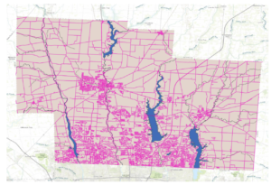
Parcel – This dataset shows all the parcel lines within Delaware County through the use of polygons.
PLSS – This data depicts all the Public Land Survey System polygons within Delaware County.
Address Point – This data layer contains all the certified address points within Delaware County. Data of homes, schools, and businesses are all recorded.
Building Outline – This dataset shows all the building outlines in Delaware, Ohio. The building outline layer is different from the address point data set as multiple distinguished buildings may share the same address data.
Delaware County Contours – Data expressed as two-foot contours for Delaware county, which shows changes in topography and elevation.