 For our final reading of the semester, we’ll review a recent article from a special issue of the academic journal Cartographica called “Decolonizing the Map: Recentering Indigenous Mappings.”
A PDF of the introduction to this special issue is here. The abstract for the introduction to this special issue reads:
“For over five centuries, cartographic map-making has played a pivotal role as a political technology of empire-building, settler colonialism, and the dispossession of Indigenous lands. Yet Indigenous peoples themselves have long engaged in their own mapping practices to share ancestral knowledge, challenge colonial rule, and reclaim Indigenous “place-worlds.” Although there is now a sizable body of scholarly literature on the mapping of empire, this special issue on “Decolonizing the Map” aims to recenter Indigenous mappings and decolonial cartographies as spatial practices of world-making. In this introductory article, we provide an overview of the theory and praxis of decolonial mapping and outline the key themes of the contributions to the present special issue. Drawing upon insights from this edited collection, we conclude that decolonial mapping requires a recentering of Indigenous geographical knowledge, respect for Indigenous protocols, and the active participation of Indigenous peoples in the mapping process itself if the project of decolonizing the map is to truly move beyond the colonial cartographic frame.”
That covers quite a bit of complex ground:
- maps as a “political technology of empire building”
- a part of “settler colonialism”
- and a means of the “dispossession of Indigenous lands”
But then also: “Indigenous peoples themselves have long engaged in their own mapping practices to share ancestral knowledge, challenge colonial rule, and reclaim Indigenous ‘place-worlds.'”
In other words, the suggestion is that mapping has been a devastating tool used against the interests of Indigenous people, but it need not necessarily be so, especially with a strategy and methodology for “decolonial mapping.”
We will read one article from this special journal issue, “Spatial Data and (De)colonization: Incorporating Indigenous Data Sovereignty Principles into Cartographic Research” by Annita Hetoeve·hotohke’e Lucchesi. This is published as Cartographica 55:3, 2020, pp. 163–169.
The abstract from Hetoeve·hotohke’e Lucchesi’s article:
“This article asks how a better understanding of Indigenous cultures as inherently scientifically rigorous can change how academic researchers do work in Indigenous communities, and how non-Indigenous researchers, particularly those in fields such as cartography and geography, can learn from Indigenous ideas of protocol and sovereignty as part of the scientific process to transform their work in our communities into something that truly benefits Indigenous peoples. In exploring these questions, this article posits Indigenous data sovereignty and traditional diplomatic protocols as a means of strengthening cartographic and geographic research in collaboration with Indigenous communities and argues that integrating these principles into such research is necessary for work that strives towards decolonization.”
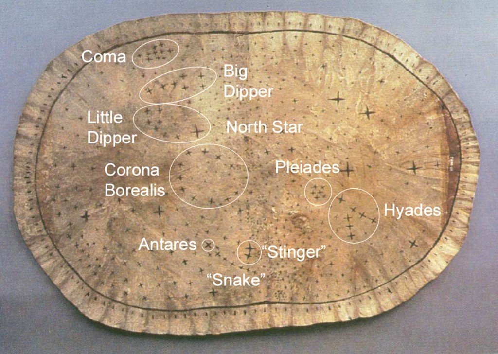 |
Pawnee “Star” Chart
|
Here too are some interesting propositions:
- Understand Indigenous cultures as inherently scientifically rigorous
- Protests by indigenous Hawaiians against telescope construction on Mauna Kea:
- “I attended a class taught at Pu’uhonua o Pu’u Huluhulu, the learning centre established at the camp, offered by Ka- leikoa Ka’eo, an elder and university professor who has been fighting desecration of the Mauna for decades. In this class, Ka’eo taught us that the Hawaiian language had words for the space–time continuum, and that Kanaka Maoli knew we as humans are made up of the same elements as the stars and that water was the basis for all life, before Western scientists could even dream of such concepts. In saying this, he reminded us that these are examples of how Kanaka culture is inherently scientific, and that expressions of Kanaka culture and self-determination are rooted in that ancestral science, and not the primitive stereotypes Western scientists and colonial agencies assume.”
- “However, it was not just the university classes that were guided by Kanaka science. The deep respect for the mountain and surrounding environment and the commitment to maintaining Kanaka cultural knowledge and relationships to the land and allied Pacific Islander communities were evident in every moment and every space in the camp. This is representative of deep knowledge of the mountain, the plants, the stars, the ocean, and the greater ecological systems of which we are all a part.“
- Protests by indigenous Hawaiians against telescope construction on Mauna Kea:
- How non-Indigenous researchers can learn from Indigenous ideas of protocol and sovereignty as part of the scientific process to transform their work in our communities into something that truly benefits Indigenous peoples
- “Though every group does them differently, the general principles remain the same; you cannot visit territories and communities to which you do not belong without first asking permission to be there, offering gifts and support to the people you are visiting, introducing your- self and saying who you are accountable to, and allowing them to determine if and how to welcome you into their spaces.”
- This brings me to the purpose of this article – if protocols and ethics review can be a powerful, moving, and at times beautiful experience in Indigenous communities, then why do we allow Western institutions to make them intimidating, bureaucratic, and something to be dreaded?
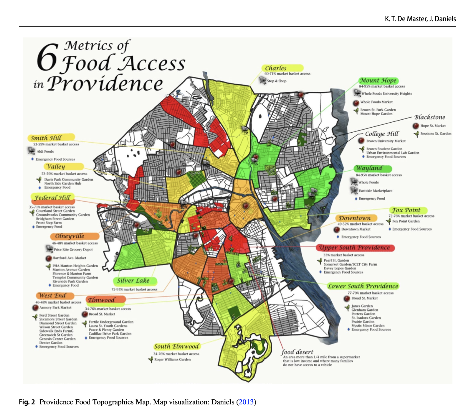
It would seem that considering the context of Indigenous people, as a source for mappable information and a guide for mapping practice, might be applicable to any situation where you are engaging with people, generating data, and mapping. For example, one might imagine how these ideas could be applied to the generation of the data for and map of the counter food desert map from the “Desert Wonderings” article we read earlier.
Please read the entire article (and the introduction to the special issue if you want).
- Specific students, please pay attention to these parts of the article, and be prepared to say a bit about them (feel free to look up additional information).
- Please also consider how these ideas could be used more broadly in mapping (eg., not only with indigenous people)
Introduction (Braden, Carroll)
Cartography in Indigenous Communities: A Brief History of Where Things Have Gone Wrong (Hayes, Wade)
- mapping as a tool of colonialism
- Dawes Act: transfer Indigenous lands to white settlers (via mapping)
- Yet: maps are not inherently colonial (or are they?)
- I’ve gotten myself in trouble over this point: in essence:
- maps emerge around 1500 as a tool of colonialism and a concept which emerges from colonialism
- many previous inscriptions (particularly in the Indigenous world) were never called “maps” nor is there such a concept or term in Indigenous languages (that I know of)
- thus the Western, colonial concept of map colonized and appropriated inscriptions and recast them as maps
- The failure of participatory mapping with Indigenous people
- Hi, I’m here from the University to help you make maps! (problem)
- Encased in Western mapping traditions, encoded in practices and software
- Belief in the folksy, non-scientific character of Indigenous knowledge
- Indigenous science need not prove itself to Western Science
-
“…this argument is not about defending the validity of Indigenous epistemologies by comparing them to Western practices. Instead, it seeks to position Indigenous practices as science in their own right, without a need for comparison. Indigenous science, and all the culturally specific variations of epistemologies and practices within it, does not need to prove itself (and certainly Western science never had to do so) or be measured or quantified; it simply needs to be acknowledged as valid and made space for.”
-
- I’ve gotten myself in trouble over this point: in essence:
Indigenous Data Sovereignty and Land-Based Best Practices
“Indigenous data sovereignty is a term used to describe Indigenous peoples’ rights to own data about themselves and their communities and to determine who accesses those data and how they are used and what data on their communities are collected and how.”
• it would be nice if all of us had this kind of sovereignty over our own data
“I build on the IPSG’s declaration by arguing that Indigenous diplomatic protocols such as those at the camp to defend Mauna Kea are an expression of political and cultural sovereignty, and their teachings can help us better articulate how to uphold data sovereignty in mapping work within Indigenous communities. These protocols are indeed uniquely suited to guide cartography projects, because they are rooted in connections to land and territory as well as building relationships across places and cultures.”
“A “best practice” for upholding Indigenous data sovereignty inspired by such diplomatic protocols might be that researchers approach Indigenous communities first by asking permission to be there, introducing themselves and the networks to which they are accountable, and offering their skills and gifts for the community to use as they see fit. This is a radically different perspective from the bulk of academic work done in Indigenous communities, and even the IRB/HSR process as framed by Western institutions, both of which are structured around receiving consent for the researcher to collect something he or she want, rather than asking the community what they need or want.”
- Each of the 13 points after “…I have attempted to summarize points such as these by offering a practical guide to integrating Indigenous data sovereignty into cartographic research…”
- (Braden) Above all else, the protocols of the specific community you intend to map should be respected, followed, and deferred to. If you do not know these protocols, or anyone you can ask about these protocols, then you are not competent or adequately prepared to do the work.
- (Carroll) Do not assume the community you are intending to map does not already have trained cartographers capable of doing the work you intend to do. Many tribal governments in the United States, for example, have natural resources departments and tribal historic preservation offices with staff who are trained to create maps in a culturally sensitive way.
- (Hayes) Do not solicit Indigenous people to participate in a mapping project they did not ask for. Instead, make it known that you have skills as a cartographer and institutional power and access to funds as an academic researcher that you are willing to volunteer and mobilize to serve an Indigenous community. Then wait to be asked for this help.
- (Wade) Do not travel to an Indigenous community for mapping-based research if you are not willing to connect with the land solely in a manner that the community feels is appropriate. Do not gather plants or medicines without permission, do not arrive with a feeling of entitlement to attend religious or cultural events, and do not expect to map sacred places.
- (Babbage) Do not travel to an Indigenous community for mapping-based research without previously extensively researching the history and ongoing legacies of violent colonization as it affects that community.
- (Frawley) Understand that as Indigenous peoples, some of our most sacred and sensitive information is the knowledge and stories we carry about our lands and significant places. This means that if you are coming to map any of our stories or knowledge, you have a responsibility to develop the cultural and technical competence to do the work in a respectful way. This should include undergoing the community’s IRB/ HSR process, sharing the work you intend to do with the tribal council or leadership, gathering gifts to give to those who share their knowledge with you, and developing a data storage and use plan in collaboration with the community.
- (Frisch) Be willing to acknowledge that open source mapping platforms could compromise the community’s data sovereignty, inform them of that in the planning process, and be willing to explore alternatives and think creatively.
- (Rousch) Understand that you may be asked to create maps that are not for public distribution, that may never be allowed to be published, because they hold sensitive information – view those moments as gifted experiences of trust, not roadblocks to publications.
- (Braden) Understand that the community has a fundamental right to own the data on their lands and people. Just because you gather it does not mean it belongs to you.
- (Gupta) Do not assume that GIS or other Western styles of mapping are useful or desirable for a project in collaboration with an Indigenous community. Make those options available, but be open to utilizing their own mapping practices in the project, and be ready to defend those practices as legitimate in academic and political spaces.
- (Hayes) Create opportunities to help in building the capacity of the community to continue to create their own maps moving forward. This may mean training interns or assistants, offering free community workshops, mentoring local high school and under- graduate students, giving the equipment and software purchased for the project to the community when the project is finished, and assisting the community with seeking additional funding to support their develop- ment and capacity to do their own mapping.
- (Wade) Do not expect an academic publication out of any collaboration with an Indigenous community. If this is something that you feel would be helpful to them or the project, let them know, ask for their permission, and offer them the opportunity to be co-authors.
- (Gupta) This list comprises recommendations for actions that are largely at the level of the individual re- searcher; that said, institutions also have a role to play. Academic funding requirements and time limitations can present challenges to researchers, but these barriers in turn require two responses: (1) researchers should attempt to navigate around these barriers by shifting to alternate forms of funding and a project timeline that invests in the work over a longer period of time, and (2) researchers have an obligation to work to remove these barriers as scholars or members of research communities by challenging institutions to shift to better incorporate Indigenous data sovereignty practices into their frameworks.
Indigenous Data Sovereignty and Cartography: Charting a Decolonized Future (Gupta)
One more recommendation: “…it’s all about relationships. As researchers, we have a responsibility to build relationships with the communities in which we work, defined by deep respect, humility, and generosity. The research will be better for it, as will our communities. No matter what culture, community, institution, or discipline we come from, we are each diplomats representing something bigger than ourselves; it is on us to represent those things in a good way, and to work with Indigenous communities and sovereign nations with the respect they command and the inherent self-determination they carry.”
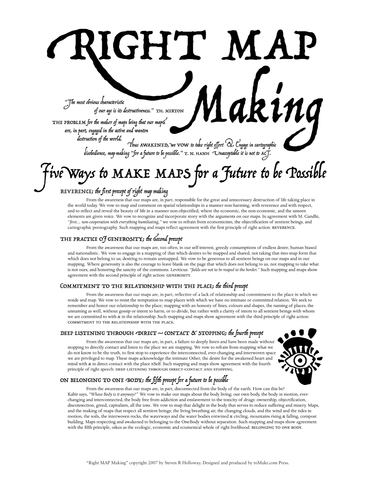






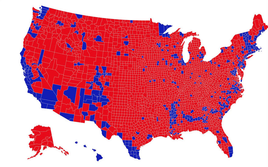
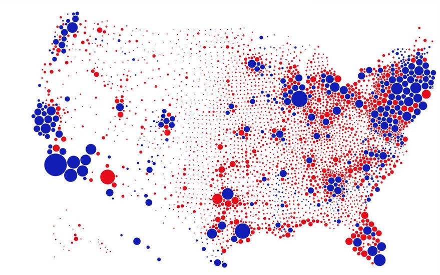
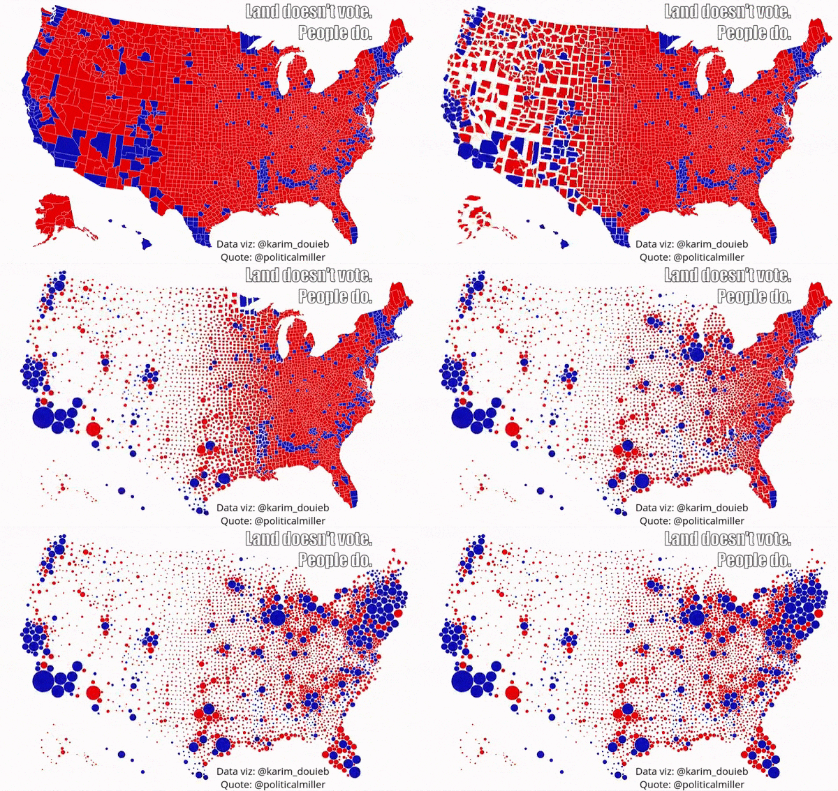 Revenge mapping: still polarized (
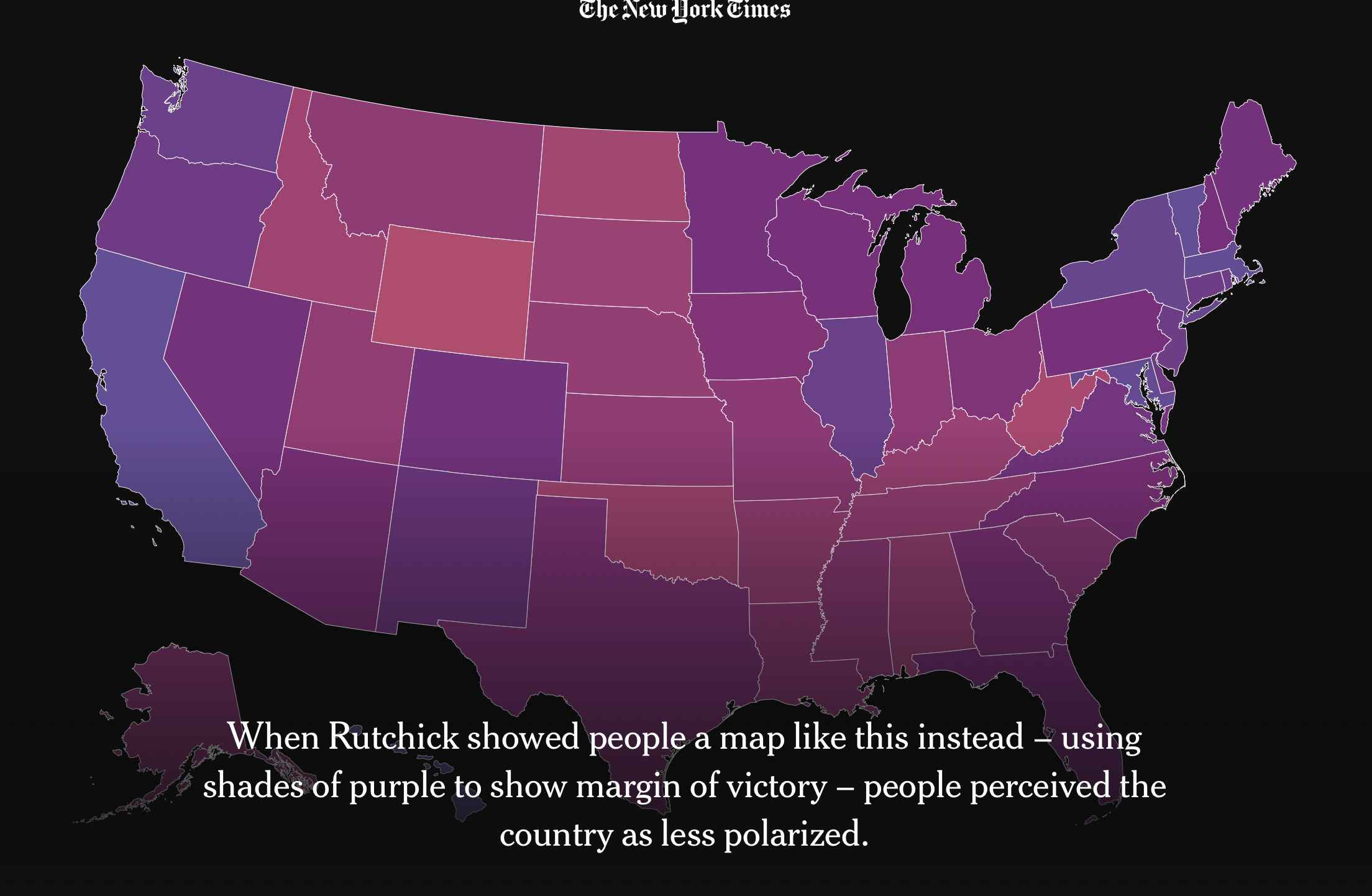
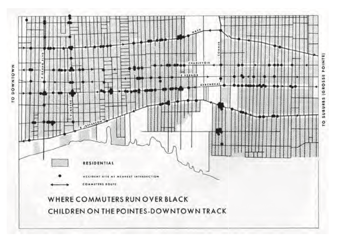 (
(
 (
(
