The Preface and Chapter 1 of GIS Tutorial for ArcGIS Pro were incredibly helpful foundations for navigating ArcGIS and what it actually means to load in and manipulate the data. The instructions got progressively less direct as the chapter went on, which helped to foster problem-solving ability and a sense of confidence in using ArcGIS. Within the actual tutorial, I really had an ‘aha’ moment with the construction of maps and their many uses, and how different choices in even color or size will change how the map is interpreted by the viewer. This was my first time seeing the construction of a map with so many variables, and it was a great introduction to the rest of the course.
Chapter 2 was a great segue into more in-depth applications of GIS. I loved messing around with how each of the zones was portrayed, and seeing how labels can be defined in different ways (and searched for to find them again later!) The questions at the beginning really helped me to visualize how these maps and changes to them are helpful in scientific studies: 1. What layer or layers are needed to represent the subject? 2. What spatial context layers are needed to orient map users to recognize locations and patterns of the subject features? Making maps usable and recognizable not only to fellow students and scientists but to members of the public who may want/need to interact with them is so important, and seeing the ‘why’ behind these tweaks and changes was crucial to my understanding of how we use GIS in social and scientific applications.
Chapter 3 was similar to Chapter 2, but much more expanded. I loved learning about the sharing of these maps and charts, specifically, and how their interpretations can change (for better or for worse) once in the public eye.
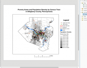
Chapter 1 Image
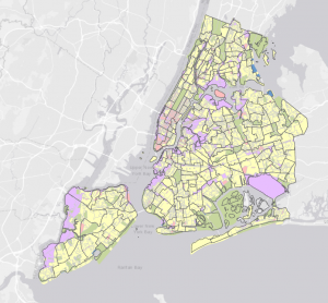
Chapter 2 Image
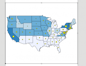
Chapter 3 Image