I read the syllabus and I took the Geog 291 quiz.
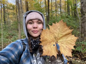
My name is Makaylin Bailey. I am a senior double majoring in fine studio arts and environmental studies. I am enrolled in this class because I would like to become more aware and be more educated in the field of modern technology that collects data about our environment.
Before this reading I had heard of GIS but never knew how impactful it is on society. Reading this actually blew my mind because I never realized how much of our everyday lives is controlled by GIS. Everything from healthcare tracking disease outbreaks to corporate businesses and even law enforcement is constantly using this.
But what really stood out to me, especially looking at it from an art and environmental perspective, is how much the whole point of it has changed. When it first beganIan the man who started the whole “overlay”, was just stacking pieces of tracing paper on top of each other on a table. It was a hands-on, artistic process, and he was doing it to conserve the environment. He wanted to make sure highways wouldn’t bulldoze over forests or ruin wildlife habitats. It was constructed to help humans stop being so destructive. But looking at today’s world, it seems like the purpose of it has completely flipped. Now it just feels extremely commercialized and highly benefits corporations. Instead of saving nature, giant companies just use it to track our digital interest and spy on our buying habits. Just to figure out where to put a new Starbucks or anything else trending on the average consumers list. It went from protecting the environment to mostly fueling giant corporations.
It also made a lot of sense to me why people back in 1988 were arguing and divided over the evolution of computers and GIS. Some geographers wanted the computer to analyze spatial data, but others wanted to print the maps out so humans could then interpret the data for themselves by using their eyes and identifying patterns using intuition. This is very similar to what modern society is debating right now with AI. It demonstrates that if we aren’t careful, the tech we build to help us understand the world might just end up being used by big corporations to control and monitor us.
This map monitor and tracks areas growing and monitoring milkweed and native plant species as well as the monarch butterfly species withing the documented areas.
Wright, Dr. Dawn. “To Save the Monarch Butterfly: Taking Action with Maps.” Esri, 10 May 2024, www.esri.com/about/newsroom/blog/mapping-to-save-monarchs.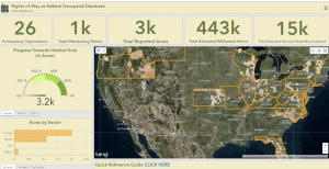
This map has Native American mound location mapped around the USA specifically the midwest to east.
Google My Maps, Google, www.google.com/maps/d/viewer?mid=1R2PaO3dIlkDTiJnG2mvYUjzEtsE&shorturl=1&utm_source=Pinterest&utm_medium=organic&ll=35.97229958940984%2C-85.97012846250001&z=5. Accessed 27 Aug. 2026.
