Delaware Data Inventory:
Address Point: Shows all the specific addresses for the county.
Annexation: Shows different parts or subdivisions of towns scattered throughout the county.
Building Outline: Shows the outline for all the structures present.
Condo: Shows all the different condo outlines.
Emergency 911 Data: Another way that shows address within the county, with a more spatially accurate data used for emergency response.
GPS: Shows all the GPS monuments made in the years 1991 and 1997.
Hydrology: Shows the county’s main water sources.
MSAG: Shows the political jurisdictions areas in the county,
Municipality: Shows the city limits of defined towns/cities in the county.
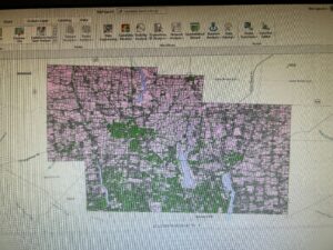
Paracel: Shows all the county’s specific zoning areas for each property.
Precinct: Shows the different voting areas within the county.
Recorded Document: Shows specific points where important data has been collected in the county.
School District: Shows all the school districts within the county.
Street Centerline: Gives accurate detail on all the roads present.
Subdivision: Shows all the subdivisions and condos as well in the county.
Tax District: Shows all the tax districts in the county.