Address Point: A maintained and certified collection of addresses in Delaware county. Its primary listed uses deal with emergency response and reporting, especially when providing the information for 911 agencies.
Annexation: Displays Delaware County boundaries from 1853 to the present. The data is up to date and is published monthly.
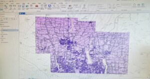
Building Outline: Shows the outlines for all buildings in Delaware County. It says that it is updated as needed, with the most recent data being from 2021.
Condo: Contains the polygons for all condominium buildings in Delaware County. In addition to the polygons it also contains information on the number of units and the recorded date of the condos, among other data.
DedicatedROW: Contains lines that represent all the ROWs (Right-of-Way) in Delaware County. The information is very up to date and well maintained, as it’s updated daily and published monthly.
Delaware County Contours: Contains a two- foot elevation map (contour) of Delaware County. Can be downloaded in the form of a geodatabase.
Delaware County E911 Data: Similar to Address Point, the E911 data contains information on the addresses in Delaware County with a more explicit purpose of emergency response usage.
Farm Lot: Shows all of the farm lots in the US Military and the Virginia Military Survey Districts of Delaware County. It’s regularly updated and clearly shows the boundaries of the farm lots.
GPS: Contains information on GPS monuments that were established between in the years 1991 and 1997. Information about the movements, such as their status (if they were destroyed or not) and their coordinates are included in the download.
Hydrology: Shows LIDAR-enchanced data of all the major waterways present in Delaware County. This data set is also updated and published on a regular basis.
Map Sheet: Shows all the map sheets covering Delaware County. Contains information such as the area and length of each map sheet.
Original Township: Contains information on the boundaries of the 18 original townships in Delaware county. This information is more historic rather than up-to-date, as the shapes of the townships were changed with tax district adjustments.
PLSS: Contains polygons that represent the PLSS- Public Land Survey System. It is updated and published regularly and helps easily identify the boundaries in multiple survey districts (including the US Military and the Virginia Military Survey Districts of Delaware County).
Parcel: Includes the polygons of all parcels and their boundaries in Delaware County. The download contains information such as the address, owner, and class of each parcel. The data in the download is also updated daily and published regularly.
Precinct: Shows the boundaries of the different voting precincts in Delaware County. The data is maintained with the assistance of the Delaware County Board of Elections and is updated frequently.
Recorded Document: Contains points that represent documents that were recorded in Delaware county. These can include surveys, subdivisions, annexations, and more. There also appears to be links to PDFs of the official document.
School District: Clearly illustrates the boundaries of each school district present within Delaware County. Includes information on the area and school name, among other data.
Street Centerline: Shows a spatially accurate illustration of the center lines of all roads (public and private) in the county. It can be used in emergency response and disaster management while also containing information such as the speed limit and name of the street.
Subdivision: Shows all subdivisions and condos in Delaware County. It is regularly updated and an effective visual illustration.
Survey: Contains points that represent land surveys in Delaware County. Each point has multiple IDs that are observable upon clicking on the point. This dataset contains the newer surveys and is updated daily and published monthly.
Tax District:Displays the boundaries of all the tax districts in Delaware County. There is information about the length and area of each district, which is all kept up to date.
Township: Shows the shape, area, length, and name of the 19 townships of the county. It’s only updated as-needed, but is published monthly.
Zip Code: Shows the boundaries of each of the zip codes present in Delaware county. You can find information about the actual zip code and name of area by selecting a polygon. The data is collected in collaboration with USPS and is updated monthly.