Delaware Data Info:
Zip Code: All the zip code areas for Delaware County. Updated regularly/as needed
Recorded Document: shows the places where recorded documents such as plat books are located (books that show how the county property is divided/landlines). other info on data collected on these lands such as annexes, surveys, etc. is also stored and represented by the dots for where they are kept.
School District: All the school districts within Delaware County.
Map Sheet: all map sheets in Delaware County.
Farm Lot: Map of all the farm lots in Delaware County provided by the US military and Virginia Military Survey Districts.
Townships: Shows the 19 townships in Delaware County,
Street Centerline (data)/ Street Centerline – DXF (document): All documented private and public roads in Delaware County. Put together using observational data, regularly updated/as needed.
Annexation: Delaware Counties’ annexed land and growing boundaries from 1853 to the present. Annexed land means land that was taken into the city limits.
Condo: All recorded condominium polygons in Delaware County.
Subdivision: All subdivisions and condos in Delaware County.
Survey: Shapefile of all survey points taken in Delaware County, excluding old surveys in volumes 1-11. All are certified surveys and more after 2004 are being added regularly.
Dedicated Row: All road right-of-ways ROW owned by the city. These are the areas of grass/sidewalk on the side of a road that is owned by the city. Not all roads have one.
Tax District: All tax districts in Delaware County.
GPS: All GPS monuments from 91-97. Uses Universal Mercator Northing and Easting.
Original Township: Original township and boundaries before tax districts changed shape.
Address Points (data)/ Address Points– DXF (document): Point layer of all address points in Delaware. Intended to support appraisal mapping, 911 Emergency Response, accident reporting, geocoding, and disaster management. The layer provides the capability to reverse geocode a set of coordinates to determine the closest valid address.
Precinct: Voting precincts in Delaware County.
Hydrology: All major waterways in Delaware County.
Building Outline 2021 (data)/ Building Outlines – DXF (document): All building/structure outlines as of 2021.
Parcel: Cadastral Parcel lines in Delaware County (property lines for real estate). Also holds appraisal information.
PLSS: created to facilitate identifying all of the PLSS and their boundaries in both the US Military and Virginia Military Survey Districts of Delaware County. PLSS is a survey system made in 1785 to establish parcel lines with a standard system.
2022 leaf-On Imagery (SID) (Map): 2022 Imaergey 12in Resolution map. A SID file is a compressed file of GIS data.
Delaware County Contours: 2ft contours of Delaware County from 2018.
2021 Imagery (SID File) (Map): just saw “Delaware County Ohio”.
Delaware County E911 Data: all certified addresses in Delaware County. Provides the capability to reverse geocode a set of coordinates to determine the closest valid address and is intended to provide 911 agencies with the information needed to comply with Phase II 911 requirements.
ArcGIS Pro Portion:
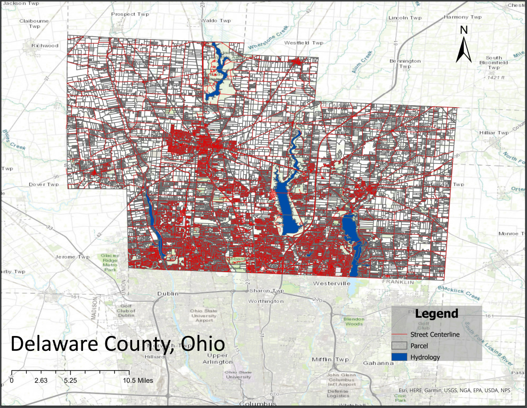
I have absolutely no idea why but when I save my map exports as PDFs it has the .pdf tab but it saves as a Chrome HTML?? When I open it it takes me to the PDF but why is it online? Here’s my map though (I should have probably made the map more zoomed in):
Weird PDF link: DelawareCountyMap
Screenshot of PDF:
