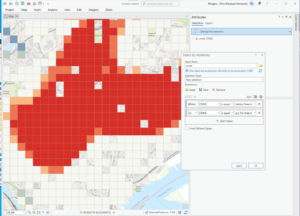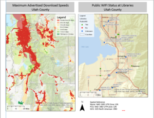


These chapters were fairly self explanatory, I only got stuck a few times but was able to skip and navigate the rest of the chapters easily. My problem is that I am inpatient and I don’t like to read everything on the screen so I miss things. The most interesting thing in these chapters for me was doing the South Sudan coding. I think it was cool to input South Suden is equal to the years or whatever the directions said. It was cool that the map and software could do that. Again, I took definitions because some of the words in the chapters were hard to understand without knowing the definitions.
Defintions:
Task: [software] A set of preconfigured steps that guide users through a sequential workflow in ArcGIS software.
Definition query:[ESRI software] In ArcMap, a request that examines feature or tabular attributes based on user-selected criteria and displays only those features or records that satisfy the criteria.
Query expression: [programming] A type of expression that evaluates to a Boolean (true or false) value, that is typically used to select those rows in a table in which the expression evaluates to true.
ModelBuilder:[ESRI software] The interface used to build and edit geoprocessing models in ArcGIS.
Model:[data models] An abstraction of reality used to represent objects, processes, or events.
Script: [ESRI software] In ArcView 3.x, one of the five types of documents that can be contained within a project file
Command line:[computing] A string of text that acts as a command, typed at an interface prompt.
Geocoding:[geocoding] A GIS operation that converts a street address or other location information into spatial data that can be displayed as a feature on a map.
Adress Locator: [geocoding] A dataset in ArcGIS software that stores the address attributes, associated indexes, and rules that define the process for translating nonspatial descriptions of places, such as street addresses, into spatial data that can be displayed as features on a map.
Overlay: [analysis/geoprocessing] A spatial operation in which two or more maps or layers registered to a common coordinate system are superimposed, either digitally or on a transparent material, for the purpose of showing the relationships between features that occupy the same geographic space.
Buffer:[spatial analysis] A specified zone around a map feature or features, measured in units of distance or time.
Dissolve: [ESRI software] A geoprocessing command that removes boundaries between adjacent polygons that have the same value for a specified attribute.
Clip: [ESRI software] A command that extracts features from one feature class that reside entirely within a boundary defined by features in another feature class.
Temporal Data: [data structures] Data that specifically refers to times or dates.
Operator: [mathematics] The symbolic representation of a process or operation performed against one or more operands in an expression, such as “+” (plus, or addition) and “>” (greater than). When evaluated, operators return a value as their result.
Cell:[graphics (computing)] The smallest unit of information in raster data, usually square in shape
Discrete data: [data models] Data that represents phenomena with distinct boundaries.
Continuous Data: [data models] Data such as elevation or temperature that varies without discrete steps
Map algebra: [data analysis] A language that defines a syntax for combining map themes by applying mathematical operations and analytical functions to create new map themes.
Aspect: [analysis/geoprocessing] The compass direction that a topographic slope faces, usually measured in degrees from north
Hillshade:[map design] Shadows drawn on a map to simulate the effect of the sun’s rays over the varied terrain of the land.
Azimuth: [analysis/geoprocessing] A compass direction.
Altitude: [coordinate systems] The height or vertical elevation of a point above a reference surface
Layout: [ESRI software] In ArcGIS software, a presentation document incorporating maps, charts, tables, text, and images.
Label: ESRI software] In ArcGIS, descriptive text, usually based on one or more feature attributes
Label class:[ESRI software] In ArcGIS software, a category of labels that represents features with the same labeling properties.
Map extent: [cartography] The limit of the geographic area shown on a map, usually defined by a rectangle.
Scale bar: [symbology] A map element used to graphically represent the scale of a map.