Chapter 6:
> Domains provide a way for you to constrain input information by limiting the choice of values for a particular field
> Using domains maintains data integrity- does not allow other values to be added during data collection
Chapter 7:
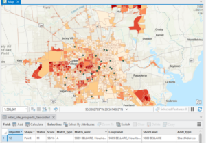
> The process of creating map features from addresses, place names, etc. is geocoding.
> To geocode addresses, you need an address table, reference data, and an address locator
Chapter 8:
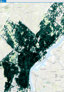
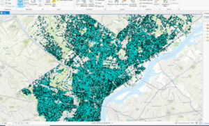

> In the first exercise, I created a kernel density to see where areas of high density may occur.
> Kernel density: the density calculated of point features around each output raster cell
> Temporal data represents a state in time
Chapter 9:
> Rasters are composed of a grid of cells instead of x, y coordinates
> Used to define and record geographic phenomena
> The reclassify tool is used to replace raster cell values with new cell values so that the rasters can be combined

Chapter 10:
> Dynamic labels are created when ArcGIS places labels for features in a layer with one click based on predetermined labeling rules.
> Useful for most mapping projects, but label positions can change depending on map scale