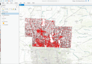
Zip Code: The data set has all zip codes in the Delaware County area. The data set is updated as needed. Zip codes are also cross referenced with the Census Bureau’’s zip code.
Recorded Document: The data set are points that represent recorded documents. Recorded documents include vacations, subdivisions, centerline surveys. Surveys. Annexation, and miscellaneous documents in Delaware county. It was created to create some kind of order to help locate miscellaneous documents.
School District: The data set has all School districts in Delaware county. This is updated as needed.
Map Sheet: The dataset consists of all map sheets in Delaware County
Farm Lot: Data set has all the farm lots in the US Military and the Virginia Military survey districts in Delaware County. This set was made to facilitate identifying all farm lots and their boundaries
Township: The data set has 19 different townships that make up Delaware County. Updated on a as needed basis. Created to help identify geographic boundaries of each township.
Street Centerline: Ohio Location based response system depicts center of pavement on streets within Delaware County. This was created from field observations.
Annexation: Dataset has Delaware county’s annexations and boundaries from 1853 till now. Updated as needed.
Condo: Data set has all condominium polygons in Delaware County.
Subdivision: This dataset has all subdivisions and condos within Delaware County. Is updated daily.
Survey: Points in this dataset represent surveys of land in Delaware County. Dataset updated daily
Dedicated Row: Data consists of all lines that are right-of-way within Delaware County. Was created through updates through the county’s parcel data.
Tax district: Dataset consists of all tax districts within Delaware County. Updated as needed.
GPS: Data shows all GPS monuments that were established in 1991 and 1997. Updated as needed.
Original Township: Data shows the original boundaries of townships in Delaware county before the boundary shapes were changed.
Address Points: The Ohio location based response system data gives an accurate placement of addresses in Delaware County.
Precinct: Data consists of voting precincts in Delaware county. Updated as needed and maintained by the Delaware County Auditor’s GIS Office.
Hydrology: Set contains all of Delaware County’s major waterways and updated on a as needed basis.
Building Outline 2021: Set has all building outlines of structures in Delaware County.
Parcel: Consists of all cadastral parcel lines in Delaware County.
PLSS: Set contains all Public land surveys systems in the US Military and the Virginia Military Surveys Districts of Delaware county.
2022 Leaf-On-Imagery: 2022 Imagery 12 in Resolution??
Delaware County Contours: 2018 Two Foot contours.
Delaware County E911 data: Ohio’s location based response system data set is an accurate representation of all certified addresses in Delaware county. Intended to support mapping, 911 emergency response, accident reporting. Geocoding, and disaster management.
