Chapter 5
first step in tasks, I want to break down what I did. County is equal to South Sudan (only select South Sudan) and Year is >/= to 2011 (South Sudan data from 2011+). This task thing was very strange I’ve never used it before.
It was interesting learning tasks but I don’t think the text explained what this step was adding very well.
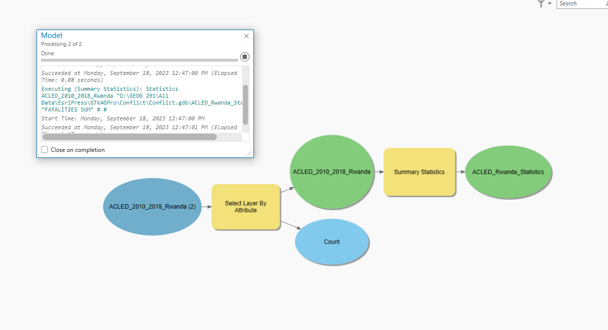
I prefer the model builder to the task route visually but the modelbuilder lacks the instructions given when using tasks so its a give and take. Here’s me running my model:
I haven’t started it just yet but I am scared to run Python code. I don’t want to run it I’d rather use the tasktool or modelbuilder >:(
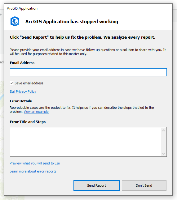
When I tried to package my project I got a “conflict” saying that a geoprocessing item failed and it couldn’t package it. This was weird because I didn’t have any failed codes, but I fixed it by removing items with errors. I wasn’t feeling very extra so I skipped the “on your own” here where I check to see if this uploaded to my online account.
Chapter 6
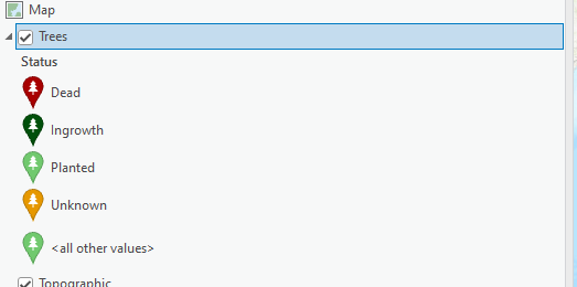
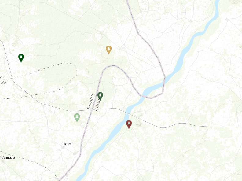
Here is my created symbols for the trees:
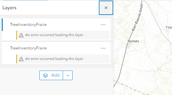
It wouldn’t let me name the project “TreeInventory” for ArcOnline (it says the name is taken) so I added my name to the end “TreeInventoryFraire”.
My map for ArcOnlinne so far:
For the app thing, there is no app called “ArcGIS Collector” so I downloaded the first one that popped up called “ArcGIS Field Maps and it took forever.
Well I downloaded it and then it said that I don’t have permission to use the app so I had to skip this part.
Attempt one at editing the new features attributes:
I got through his exercise but it was weird. I had to keep reopening my project because the program was losing its location and said it didn’t exist. I think this screwed with the portal linking to my online account because after refreshing and readding the layer it said that it couldn’t find it either. I think it might be because I had to give the online layer a different name since the map name was “already in use”.
Regardless, I now know multiple ways to edit maps from many devices!
Chapter 7
Starting off strong with more so actions like “join these two layers” instead of a step by step. Getting harder! Let me know I need to pay attention to what I’m doing more.
When I tried to save the locator it originally said that a parameter was missing. I think it was because I put “Houston_” and not “Houston_Locator”. File names are important (And annoying).
I don’t really understand what rematching did. I read the text and it’s still a little confusing. I have actually little to no idea what this did. Did it just match addresses that are the same but weren’t classified as the same?
My map after doing the merge, dissolve, and selected specific properties within the buffer:
When I opened the attribute table after the spatial join I only saw one row of data…I chose the wrong input for my spatial join! went back and fixed that annnndd it still looks the same D: Looking at the attributes of the buffer, it only shows one row of data as well.. I’m not really sure why this happened. My clipped layer and the following selection layer look fine in the attributes. Tried for a third time and it worked! I think I was selecting the wrong inputs, pay attention Logan.
Our pop-up menus look very different than the book.
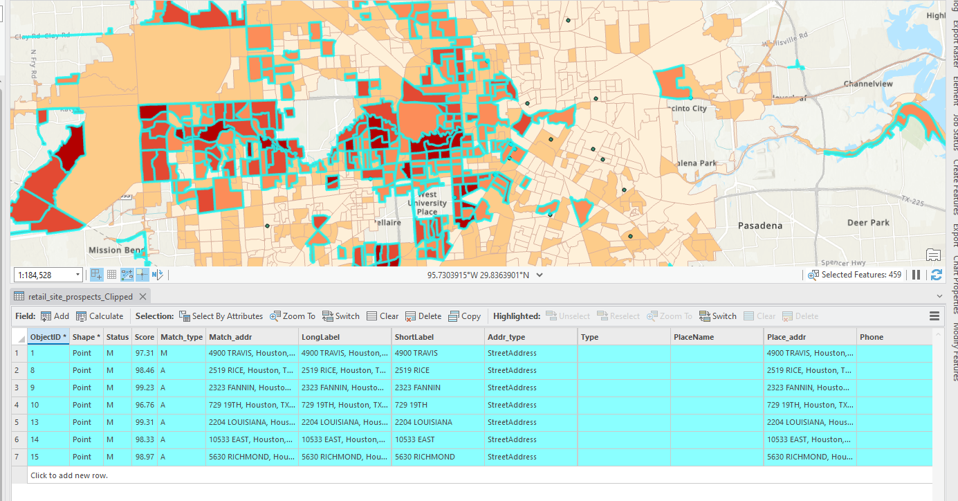
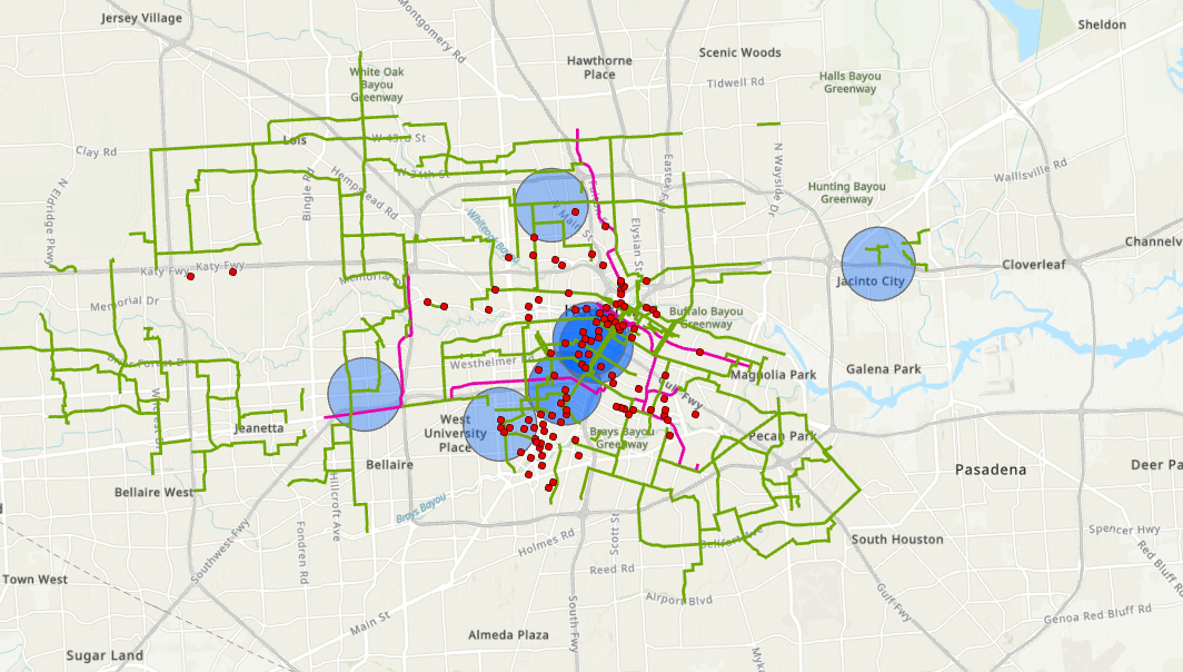
My final map of this exercise with some selected prospective property locations, proposed/existing bike paths, and bike stations:
Chapter 8
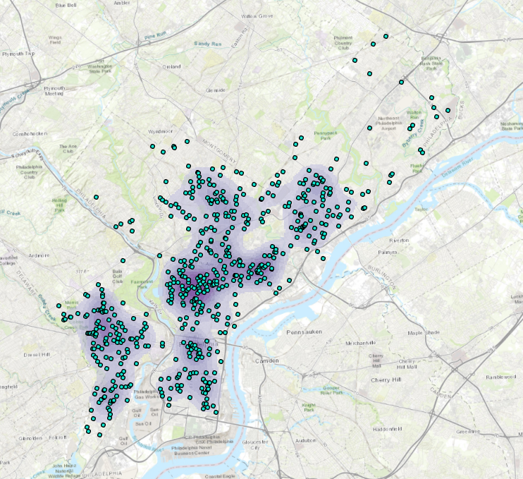
My first map of robberies in January, how exciting:
I didn’t really consider the applications of GIS with crime. It obviously makes sense but it just adds another use of GIS for me.
Every time it says “run the tool” it reminds me of the artist group Run the Jewels
negative points for bringing in the empirical rule and z-scores. Stats = no.
I hate this:
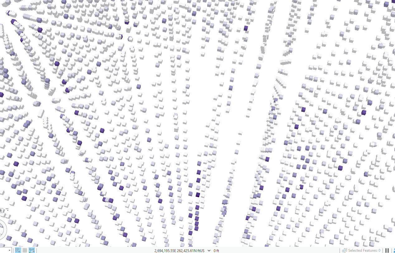
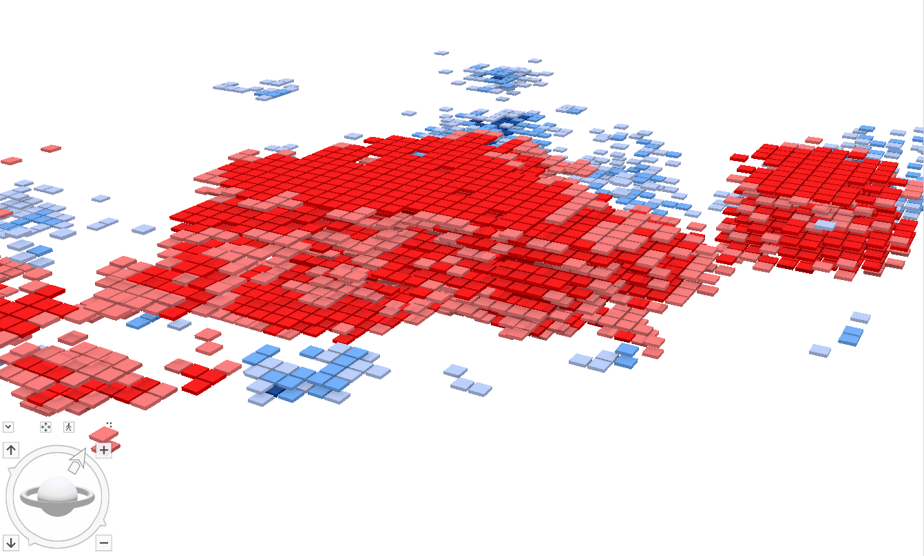
real vomit from all these cubes. It feels like the matrix:
I don’t want to work documenting crime spots, that’s for sure.
I did 8c and got the mods done. I just noticed that there is no topography for this scene. Not really a problem because I can work but odd:
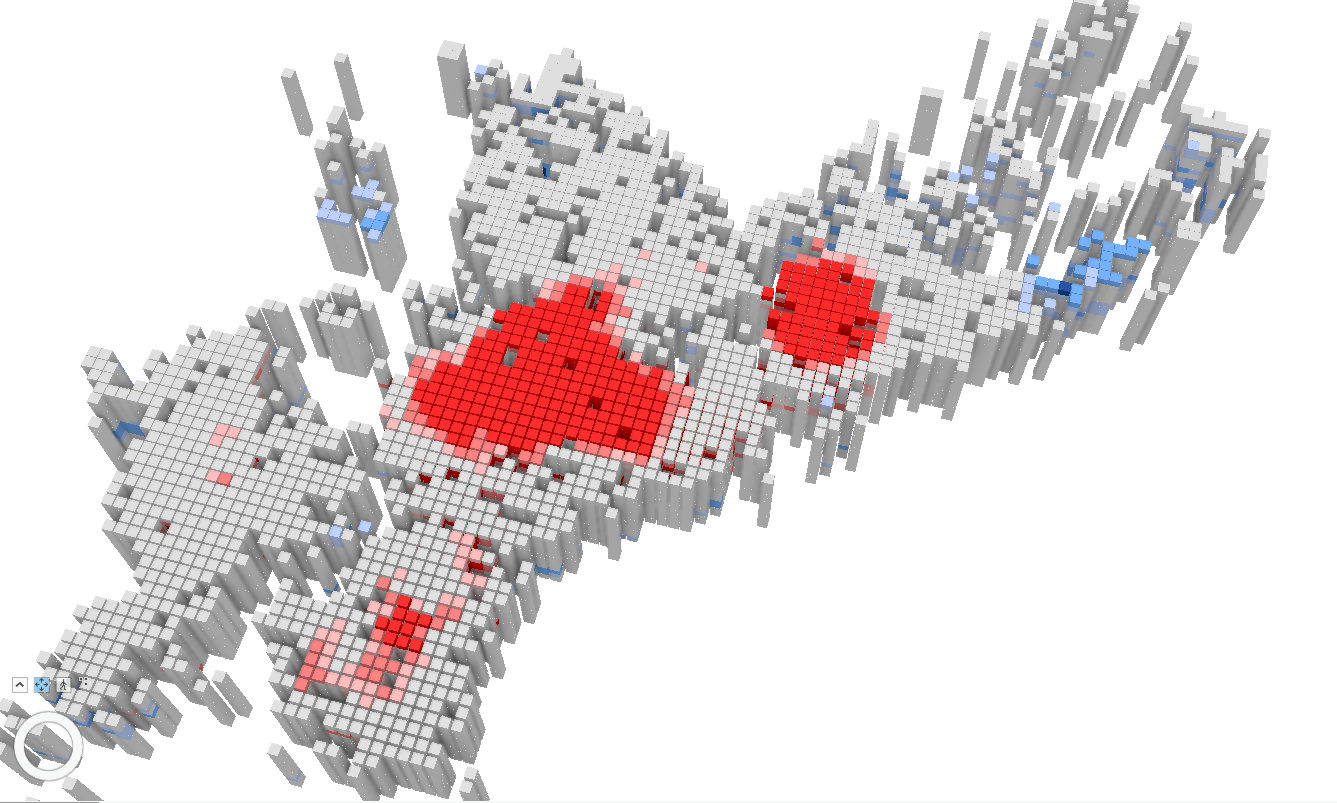
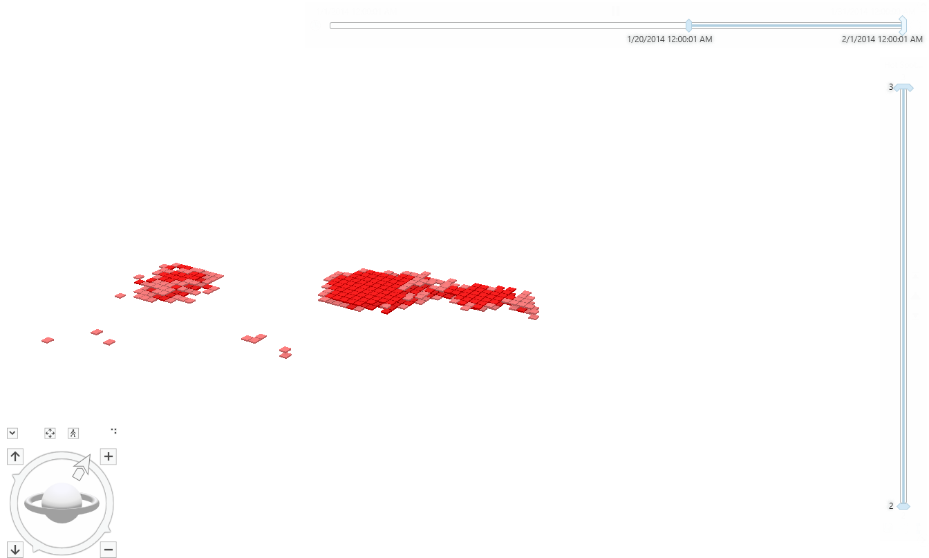
Range and time on crime son (it’s playing in the picture so it looks a little empty right now):
Chapter 9
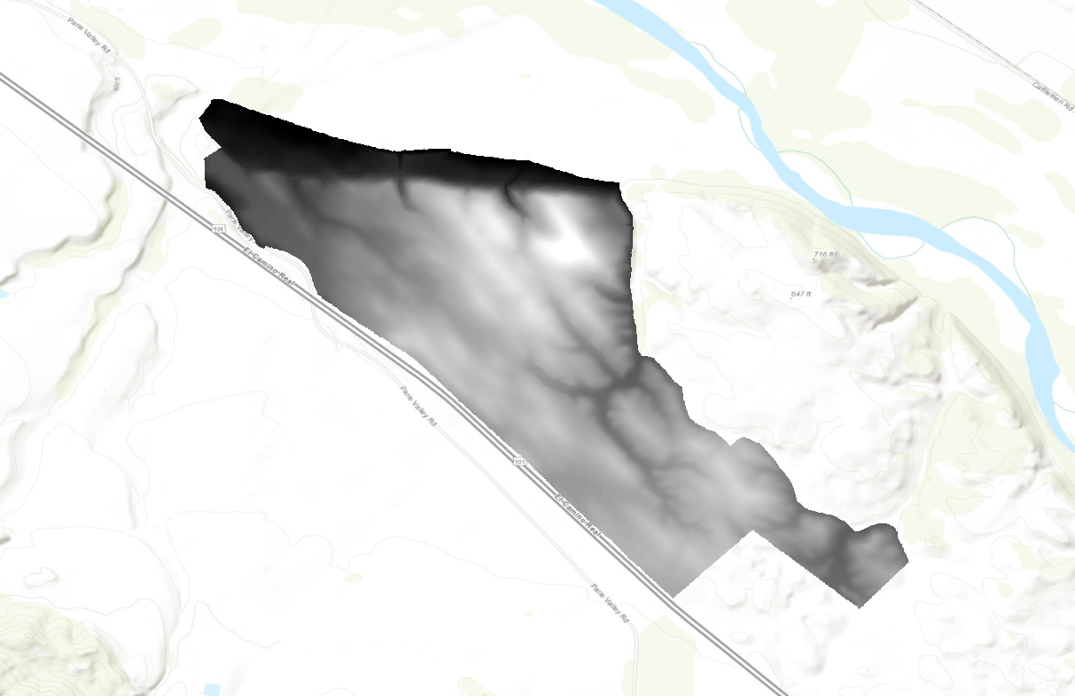
I started by extracting masks and mosaicing layers to make this property boundary:
Running the aspect tool and seeing the colors brings back trauma from remote sensing. I know these colors all correlate to the cardinal direction of the slope.
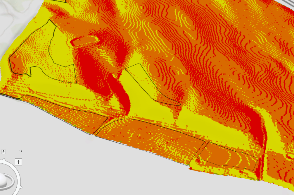
When adding the outline to the planting sites I made it purple instead of black because it was hard to see on the hillshade that was already greyscale and the slope added green/red. I promptly changed it back after adding the slope.
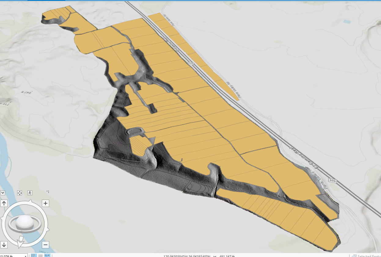
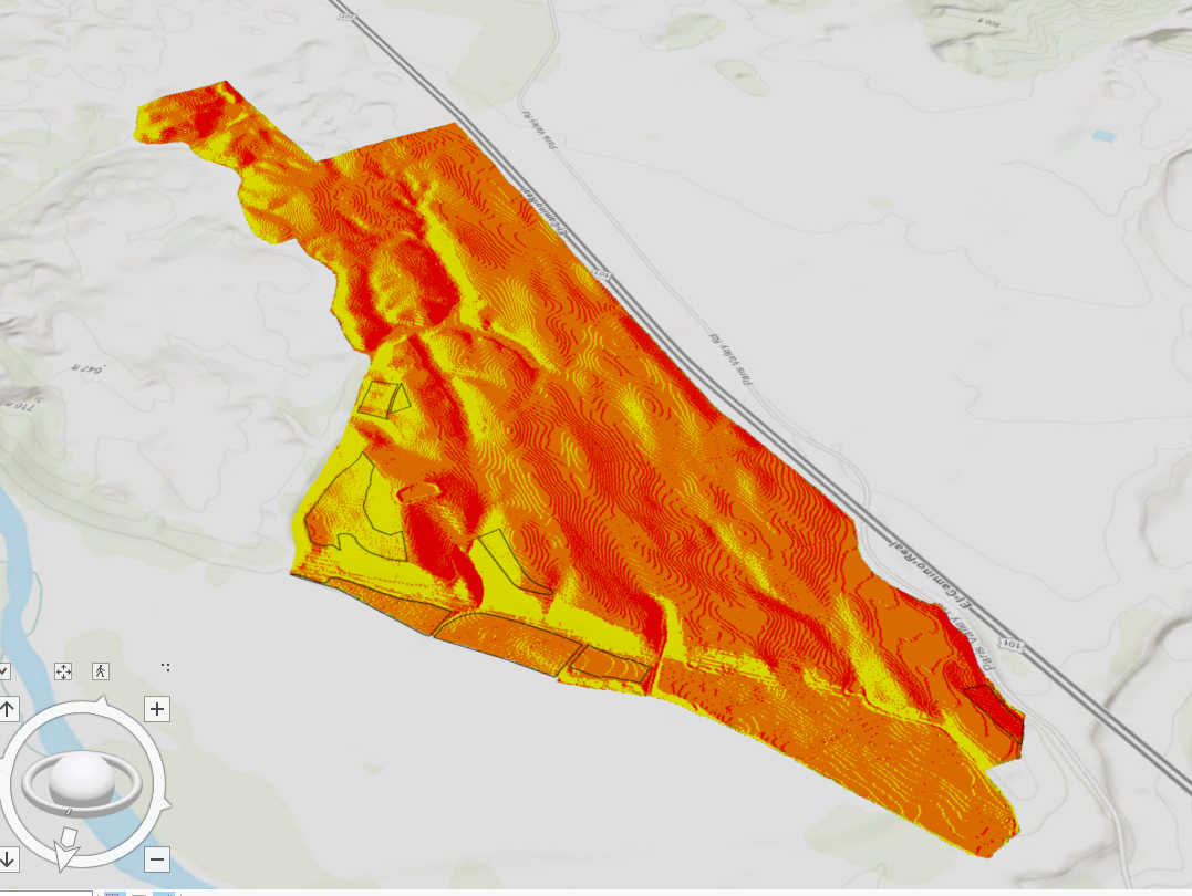
Here is my map with the property boundary, vineyard blocks, and planting sites. I also have on the 3pm hillshade shadow. There is limited area for planting on this property:
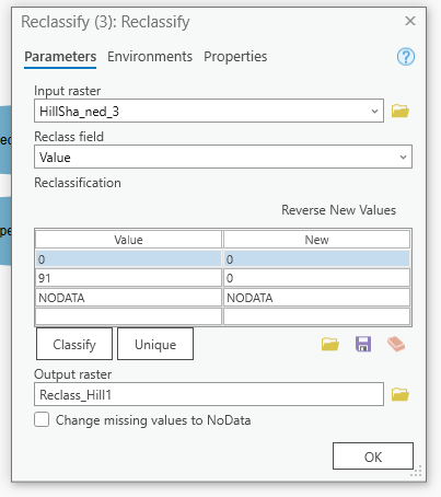
This modelbuilding reclassification probably won’t work. I don’t have a start and end column, only value and new.
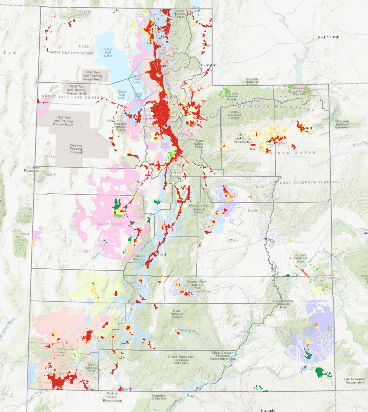
My finished maps after raster calculator (which was being a little stinker). The dark red shows the most favorable planting sites within the black outline:
Chapter 10
My first map for 10a:
I didn’t have a symbol selection in my label ribbon. I had to right-click the layer and select labeling properties to get to the symbol tab it asked of me.
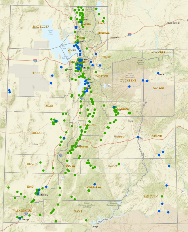
My created labeled map of Utah:
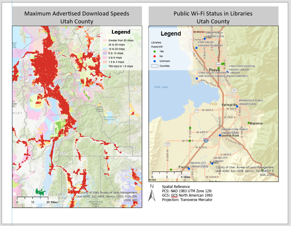
My finished layout of broadband speed/libraries in Utah County. (I have no idea why it made the pdf a html link? This has never happened to me before. I included a screenshot of the map because the link doesn’t even work.)