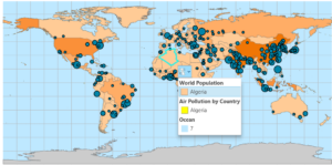
In ArcGIS pro we will be completing projects that have maps, layouts, layers, tables, tasks, tools, and connect to servers, databases, folders, and different styles. ArcGIS Online is public content that if connected to an organization you can share projects and information. Geoprocessing tools will perform spatial analysis and manage GIS data. Cluster → aggregating.
I ran into an issue that there was not a purple school symbol so I substituted a blue school symbol. There must’ve been an update with symbols. The ToBreak attribute helps to show how many minutes walking a distance is. I got stuck on chapter 1, step 9 “Under Try a drawing style, select Types (unique symbols). I could not find “Try a drawing style”. I ended up stopping for the day and came back and found it. After just starting exercise 2B I ran into a labeling issue. The appearance tab is now labeled as “feature layer”. It was cool to transform my map into a 3D form and use the explore tool to navigate around. When trying to export their selection to a new dataset I ran into issues at #3 in the Geoprocessing pane. All of exercise B was messed up and I had questions about a step that was very important because it carried over into exercise 3B. Stopped at page 91 on Import layer symbology. I ended up completing chapter 4 but could not save any progress because of a computer issue.

