Gensler – Week 4

Preface:
The preface was helpful as it helped me to understand how useful this book was with the fact that you can download tutorials straight from the book. I thought that was very interesting that it included some of the history of GIS as well

Chapter 1:

This was my first time interacting with GIS and I really enjoyed getting to know ARCGIS Pro and getting acquainted with mapping. I was really interested in learning about GIS and the book did a really good job at explaining how to get started with mapping.


Chapter 2:

This chapter really helped me start feeling a little more independent with GIS and the processes within the application. Being able to use everything I just learned on a much larger scale was very helpful to me and allowed me to understand many of the intricacies of GIS much better.


Chapter 3:

Chapter 3 was helpful and I liked being able to make the key for the map in question and the graph. Learning how to share maps online was very helpful as well. Overall, I thought that these 3 chapters were very interesting and gave me a much better understanding and appreciation of map making

Gensler – Week 3

Chapter 4:


This chapter is about mapping Density which reveals where certain features are concentrated. It does this by standardizing values by area to make the comparisons a lot clearer. This is especially helpful when you are working with larger data sets like censuses and crime reports. Before creating your own density map, you should make sure you know what feature you are mapping so you can reveal the proper patterns and information that you are looking for. One of the methods to track density uses defined boundaries and includes dots for tracking or has that area shaded based on the density of what you are measuring. The second method uses a continuous density surface and includes a spreading feature that shows change over time and to highlight hotspots. Area based mapping methods are pretty simple and are very useful for unit comparisons. Density surface mapping which uses more statistical information that helps to show detailed patterns. Overall, both methods to mapping and tracking the concentration of information are very helpful to highlight trends. 


Chapter 5:


This chapter is about what is inside an area which can help to reveal to see if certain features occur in said area of interest.  This use of GIS is extremely useful for monitoring different activities within a certain area and comparing areas based on what is inside. There are a few things that you need to identify before using this method, one of these things are discrete locations, roads, and areas. You also need to identify continuous features such as categories and values of this area that you are looking into.  When looking at an area and analyzing it, there’s three methods to do so. One of these methods is drawing areas and features which gives you a simple and quick overview of the boundaries. The next method is by selecting features within an area, this allows you to look at lists and counts of features within your data sets. This allows you to see the overall statistical view of your desired area. The final method involves overlaying areas and features, this combines the boundaries into new data sets and calculates summaries for that overall area. This method works with multiple areas and it’s most detailed, but it also requires the most processing out of the three methods. Overall one of the highlights of GIS is using it to see data and change over time within an area and there’s many ways to do that effectively. 


Chapter 6:


This chapter is all about using GIS to find what’s nearby when looking at a map. The purpose of doing this is so that you can monitor events to find certain areas and identify groups of specified data sets.  You can also see what’s in a certain distance of the features that you’re interested in looking at. When defining the analysis, nearness can be measured in two ways: straight line distance which is a simple area of influence or network distance which might be the amount of time it takes to get to a certain place that you are mapping. There’s two types of methods when looking at the nearness of an area: there’s planar which is when you’re looking at small areas like a city or county, and there is also geodesic which is a larger scale region or even a global analysis.  As we learned before some of the results that we can see are lists counts and summary of statistics. 

Gensler – Week 2

Chapter 1:

The book introduces what GIS is and many of its various uses. It offers a good starting point when looking at the analysis side of GIS. It describes how when you are doing analysis, you always start out with a question that guides your process and how you understand the data. To begin this chapter, Mitchell did a great job at laying out all the important steps that go into a GIS inquiry. There are two ways that geographic features can be represented within GIS: vector and raster. In a vector model, each different feature is represented in a row within a table and features shapes that are defined by x,y locations in space. Streams, roads, and pipelines are all things that are commonly represented as a series of coordinates. In the raster model, different features are shown as a matrix of cells based on the original map. Changing the cell size in the model can result in analysis being slower and is not effective for storage. This model is good for showing the different types of features within the area. With both model systems, all data layers should be in the same map projection and coordinate system. When using these models, some attribute values are ratios, amounts, counts, ranks, and categories. Categories are groups of similar things. Counts and amounts both show the total numbers. Ratios show the relationship between 2 quantities and 2 things. Ranks put things in order, from highest to lowest. When working with a data table, three of the most common operations that are performed are selecting, calculating, and summarizing. These all allow the user to interpret the data that’s being analyzed properly. 

Chapter 2:

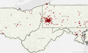
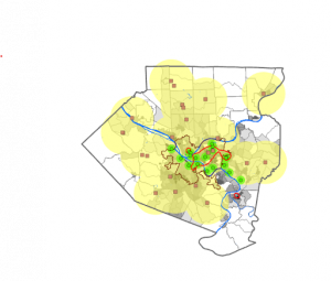
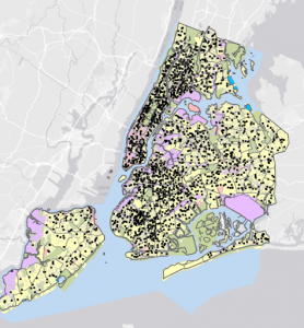
I found that chapter 2 was especially interesting as it highlights how GIS can be used to identify and evaluate cause and effect relationships. I liked learning about the process of collecting and preparing the data that is being analyzed. When assigning geographic coordinates you can use either input a street address or a pair of coordinates. No matter if you are tracking multiple types of data or just one, you can still learn helpful information. GIS is also very helpful as it stores the location of each geographic feature. If you are mapping and have more than seven categories then it is helpful to group some of these categories together to make it easier to effectively visualize the map. The reading offers two examples of maps where one has many categories while the other only has a few groupings. This change is very noticeable with the map with many less categories being much easier to read and observe. When combining categories, it’s important to group them properly so the data can’t be misinterpreted. It is also important to not combine the categories into too few groupings as it might make patterns harder to identify. Overall, this chapter was really helpful in shaping my view of GIS and how the mapping feature works in it. 

Chapter 3:

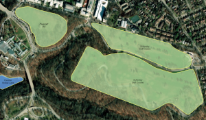
This chapter helped me to understand how GIS operates in terms of statistics. There are three kinds of data that can be mapped: discrete features, continuous phenomena, and summarized area data. Discrete features are individual locations such as linear features or areas. Continuous phenomena are areas or values that are represented as contours, graduated colors, or a 3D perspective. Data summarized by area is usually depicted by shading the area of interest or by using a chart that organizes the data in question. How this data is also important as there are multiple ways of doing so. Some of these options include using points and lines to display the information that is trying to be analyzed. When making a map, it is also very important to know what is your goal with said maps. depending on whether you are trying to explore the data or present the information, your means of doing each could change. 

Gensler – Week 1

Hello, My name is Cooper Gensler and I am a sophomore, majoring in Environmental science and Geography

After taking the syllabus quiz, I completed the reading where I learned all about what GIS is and how it is being used to learn more about the physical world and its various implications. I found it very interesting how GIS is used by many different companies or people to find out different information using the same processes. One of the first recorded uses of GIS was in 1962 as it was used as a method to process cartographic information and then analyze said information. It was originally used by Ian McHarg who was constructing a highway and wanted to make it so it would be the least disruptful to the natural environment. McHarg did not use a computer as he layered pieces of tracing paper with sections such as housing, forests, and valleys on those papers. With this, he could effectively trace the path for a highway while successfully limiting the amount of wildlife that was misplaced. Learning about GIscience and GISystems was really neat. GIScience is primarily the computer based side of GIS as it describes why certain processes occur using justification and theoretical bases. This is opposed to GISystems which use processes to get a certain output. GISystems is what we as students are being taught and is more accessible to every day use. Overall both sides of GIS are incredibly important to how information is processed. GIS in general is a very powerful tool in how information is visualized across many different systems of earth. It can help convey information that can display how different parts of the earth are connected.


Analysing Fish Species Distribution on Forest Land with Intersect Tool in  ArcGIS | Intersect Tool

in this map, ARCGIS is used to display the distribution of fish species in the Western US. I thought that this was a very helpful and insightful graphic that shows information that would be helpful to someone who is a marine biologist or an adjacent field.