Chapter 6:
Exercise 6A: On page 206, when the book asked me to open the catalog pane, expand databases, click TreeInvenory.gdb and click domains, no domains showed up in the domains window. The book says I should have a Hazard and LandUse domain but I do not. I was not able to complete exercises 6B and 6C because I couldn’t complete 6A and there was not an option to upload a finished map to pick up where I finished. B and C use arc online and the arc collector mobile app with the published treeinventory map from 6A.
Chapter 7:
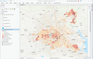
Exercise 7A: This exercise went smoothly with no issues, I was able to open the data and generate the map without a problem. However, when I got to Exercise 7B: I wasn’t able to do the rematching step because when I typed in the addresses no unmatched addresses appeared. I wasn’t able to do exercise 7C because I couldn’t complete B and rematch the addresses. The image below is what my map looked like after completing chapter 7, without the rematching step being done. I wonder if we had let the GIS automatically rematch (pg. 247), instead of clicking no and trying to do it ourselves it would have been able to do this step.
Chapter 8:
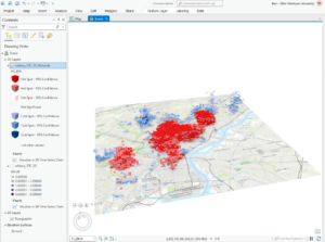
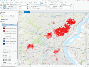
The exercises from chapter 8 went well. I was apprehensive about making the space time cube because it sounds so complex but the GIS cooperated and I was able to complete all the steps. I think the end results are really cool, specifically being able to visualize the robbery hotspots 3 dimensionally.
Chapter 9: I got through exercises 9A and B smoothly but couldn’t finish exercise 9C because the reclassify tool from the model builder portion of the exercise did not have the same table built into it as the table in the book (pg. 344). I didn’t have a start, end, and new table like you need for the exercise and therefore couldn’t complete the model builder.
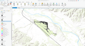
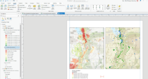
Exercise 10: I completed 10A and B without issue until the very end of 10B where I had to change the county names to a brown color. I couldn’t get the symbology to appear on the map and look like the pictures from the book, even though I think I followed the instructions to a T. i got lost in all the formatting that we had to do at the very end of chapter 10. I couldn’t find all the panes and tools that they were asking for and also couldn’t get my maps to format the way they needed to. Also, when I uploaded the map on the left it appeared in the shape of a football and the best I could do was format it zoomed in like it is now. This was frustrating and definitely something that I could use some more experience with.
Big idea reflection: These chapters built on the work we did last week while also introducing new skills. I think I had an easier time working through the steps and was more comfortable with Arc Pro. I enjoyed feeling like I knew my way around, although I was still frustrated at times by not being able to find things or by the GIS not doing what I wanted it to. In terms of big ideas, I thought that the space time cubes from chapter 8 were really interesting and I can see how they can be used to illustrate patterns and create really beautiful interactive maps. I also appreciated the hillshades and extract by mask/mosaic-ing we did in Chapter 9 because these are things that I have done with Dr. Rowley. Using the book to show me the proper way to do this was excellent and I appreciate having a concrete place to look if I ever get stuff mosaic-ing or generating hillshades in future research.
All good. You stuck with it and got most of the stuff in the chapter done beyond the goofy errors. Regardless, I think you are solidifying your ArcGIS Pro skills.