Preface:
The preface went over what this tutorial/book is about. It briefly talked about what the chapters are over and what applications you will be using GIS for. It went over the software and different websites of ArcGIS to expand upon your map. It talked about the different tutorial sets along with this content being a learning system of 25 years of experience.
Chapter 1:
Chapter 1 had us exploring a map and getting familiar with a lot of the tools and things you change on a map. It went over navigation of a map, symbology, working with the attribute tables along with labeling maps and using keys.

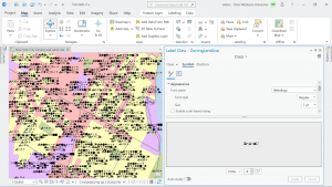
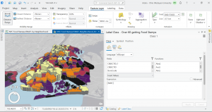
Chapter 2:
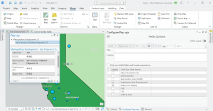
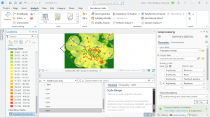
Chapter 2 took a look at map design and how to visually look at qualitative attributes. Things like dot density, symbolizing these values and changing their color, doing a definition query to look at a specific set of the attributes visually, and a choropleth map.

Chapter 3:
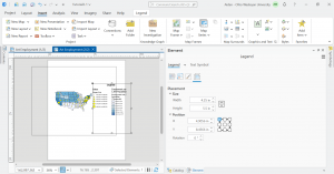
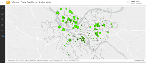
This chapter dealt with building map layouts, presenting your maps, and sharing them. Made a map key for the 3-1 tutorial map, fooled around a bit with the sizes and colors. I learned to share a map to ArcGIS online along with writing a summary and putting tags. When I tried sharing, it looked like the OWU wifi was too slow (?) and wouldn’t let me upload, because of this I couldn’t do the 3-3 tutorial but I read through the steps and got the gist of creating a story. I was able to upload 3-4 map and went into ArcGIS online dashboard.