Preface
The preface to GIS Tutorial for ArcGIS Pro 3.1 greets readers to the fifth edition of this comprehensive, step-by-step workbook. The workbook strongly focuses on creating, analyzing, and sharing 2D and 3D maps through portals such as ArcGIS Online and Living Atlas. It uses a systematic learning approach that combines lectures, lab work, and student-driven projects and provides step-by-step tutorials, assignments, and lecture notes to support learning.
Furthermore, the book illustrates actual-world, real-world applications such as poor population’s health access analysis, crime data mining to detect patterns, mapping poverty indices, and urban planning based on LIDAR data. The learning process is organized into three divisions: working with maps already available, preparing and managing spatial data, and problem-solving through spatial data analysis.
Chapter 1
At first, I didn’t know where things were, and it took me some time to figure it out. However, I tried to take my time and carefully follow the steps in the text.
I was especially happy when the bookmark I created actually worked.
Chapter 2
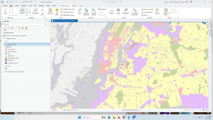
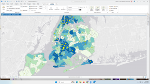
In this chapter, I operated the Symbolize function many times, which helped me understand how it works in depth. What I found especially interesting was learning how pop-ups disappear when zooming in and reappear when zooming out. I had often seen this behavior in Google Maps, so it was fascinating to understand how it actually works.I also realized that combining colors and symbols makes the map much easier to understand. In Tutorial 2-6, I learned that simply changing where to set custom classifications can make information on the map much more readable.
Chapter 3
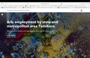
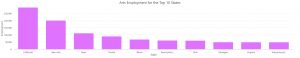
I learned how to actually share a map and also how to edit a shared map. I realized that many of the tasks in Chapter 3 can be done from my own computer, and once a map is created and shared, it can be edited anytime and anywhere, with the option to add graphs and tables. I thought this was very convenient. Moreover, I felt that not only sharing the map but also including it in a web-based story helps readers understand more deeply. I was glad to learn how to create this as well.