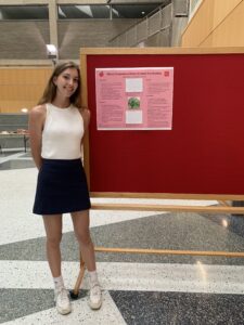
About me 😎
My name is Jocelyn Weaver and I am an environmental science and geography major with a botany minor. I am from Hudson Ohio which is around Cleveland. I am a junior and on the track team on campus (I throw javelin). I like hiking and being outdoors, my favorite food is mashed potatoes, and I am on the student Envs board. I am excited to learn more about GIS and use it potentially in a future career. 
Comments on Chapters 1: GIS: Short introduction
-It is true, when I tell people I do research involving GIS, most people do not know what that stands for
-Interesting how the idea of overlaying came around in 1962 and was the original idea for GIS basis
-The article brings up multiple angles in which GIS is looked at by different people and how people categorize it like wether its quantitative analysis or an extension of mapping which is an interesting concept
-It interesting all the ways GIS can be used and applied, which people do not regularly think about like farmers and what you eat and where it comes from and how to get to your local supermarket
-Never heard the term “leap-frogging” before and the example of people in sub Saharan Africa never having a landline but having cellphones now
An urban storm-inundation simulation method based on GIS by Shanghong Zhang and Baozhu Pan
I looked up GIS storm water management and multiple articles came up using GIS and other data sources to predict and map land to show where storm overflow water would go. This article specifically talks of a new method USISM to simulate urban storm inundation. Due to urbanization and other human factors flooding is more frequent. To be able to find inundation quickly an urban storm-inundation simulation method (USISM) based on GIS is proposed. GIS technology is used to find depressions in the land and other data such as digital elevation model (DEM) to obtain flow order of the depressions.

Arc StormSurge: Integrating Hurricane Storm Surge Modeling and GIS by Celso M. Ferreira, Francisco Olivera, and Jennifer L. Irish
Arc storm surge is a a GIS application that models data involving hurricane waves, surge models, simulating waves nearshore, and wave models and hydrodynamic models. This program involves pre and post processing tools to help spatial data and numerical modeling. Hurricanes cause immense costal flooding and damages and which these prediction models will be able to understand the events of a simulated hurricane storm surge. 
Citation
Zhang, Shanghong, and Baozhu Pan. “An urban storm-inundation simulation method based on GIS.” Journal of hydrology 517 (2014): 260-268.
Ferreira, Celso M., Francisco Olivera, and Jennifer L. Irish. “Arc StormSurge: Integrating hurricane storm surge modeling and GIS.” JAWRA Journal of the American Water Resources Association 50.1 (2014): 219-233.
All good. Javelins and mashed potatoes. Here is an article on GIS and potatoes: https://cipotato.org/blog/the-secret-to-potato-mapping/