Chapter 1:
Tutorial 1-1
- This tutorial served as a great introduction for learning how to navigate ArcGIS Pro. I learned how to set up projects for future use, save a project into an .aptx file, and add and remove a basemap.
Tutorial 1-2
- Learned how to use a pop up window, zoom in feature, zoom in to raster feature class, bookmarks, and search for a feature.
Tutorial 1-3
- Learned how to work with attribute data, open a table, work with the fields view of an attribute table, select records and features of a map feature class, and obtain summary statistics.
- All attributes are those provided by a Census Bureau. You can change the order, names, and display names of attributes.
Tutorial 1-4: This tutorial popped up with an error, so I wasn’t able to complete it
Chapter 2:
Tutorial 2-1
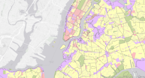
- Learned how to symbolize qualitative attributes and display polygons using unique value symbols
Tutorial 2-2
- Learned how to label features and configure pop-ups, change label properties, remove duplicate labels, and manage pop-ups
Tutorial 2-3
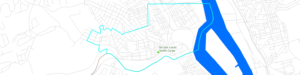
- Learned how to filter with definition queries, create a definition query, and symbolize figure and ground features.
Tutorial 2-4:
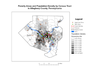
- The layer that this tutorial wanted me to use said that it did not have a valid data source so I imported the neighborhood data set to fix this issue. Learned how to create choropleth maps for quantitative attributes, create a choropleth map, and extrude a 3D choropleth map.
Tutorial 2-5
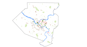
- Learned how to display data using graduated and proportional point symbols and create a map of graduated-size points
Tutorial 2-6
- Learned how to normalize populations maps with custom scales, create a choropleth map with normalized population and custom scale, and import symbology and use swipe to compare features
Tutorial 2-7
- Learned how to create dot density map
Tutorial 2-8
- Learned how to set visibility ranges for labels and feature layers
Chapter 3:
Tutorial 3-1
- Learned how to build layout and charts, create a layout and add maps to it, resize and place maps, add guides and snap maps to the guides, insert legends, insert text, and create charts
Tutorial 3-2
- Learned how to share maps online, set properties online, share maps in ArcGIS Online, Use map viewer in ArcGIS online, change the style of a layer, and configure pop-ups
Tutorial 3-3
- Learned how to create a story in ArcGIS online, add blocks to the introduction, add a sidecar block with a map, add content for the left panel of the map, enable navigation, add credits, and previous and publish a map
Tutorial 3-4
- Learned how to create a dashboard in ArcGIS Dashboards, add a map element to the dashboard, add a table element, adjust the dashboard, add a serial (bar) chart, add interactions to the dashboard, and finish a dashboard
*for some reason all of my other screenshots have disappeared, so unfortunately this is all that I could provide.