1.1 This was a good tutorial and I was glad to discover arcGIS is very similar to other programs I’ve used in terms of basic navigation and UI design, so it all felt pretty familiar.
1.2 Standard stuff, moving around the map, making different layers visible at different levels, pop-up windows and some very basic SQL.
1.3 More in depth info about using and manipulating attribute tables, fields of view for attribute data, and using the Statistics tool.
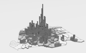
1.4 Symbols are fun! Learned how to change symbols and colors with the symbol window. Learned how to alter labels and add feature classes to the map. 3D maps are so cool. I love this.

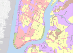
2.1 Changing symbol colors, outlines etc. Learned how to change feature colors using unique values to make maps easier to understand.
2.2 Learned how to change label properties, use the conflict resolution tool to prevent overlaps, and edit/ remove pop-up windows for each layer.
2.3 Learned how to make a sub selection of data in a feature layer using SQL and changed the symbology to be more legible.
2.4 Was corrupted, did not work.
2.5 Learned how to analyze data to create symbology that displays the overlap between 2 sets of data.
2.6 Learned how to make normalized population maps and show multiple overlapping layers without turning one off.
2.7 Learned how to create a dot density map and alter the dot size and characteristics.
2.8 Learned how to set the visibility for different zoom levels on individual layers.


3.1 All of the chapter 3 files were corrupted except for 3.3 which was missing. Redownloading the files did not fix this.