Hello, my name is Evan Miller. I am a senior, and my major is Zoology. I run both cross country and track and field here at OWU. I also have a passion for birds, as I want to pursue conservation work in the field of ornithology down the road.

Honestly, I never heard of GIS until a friend of my recommended the class to me. Knowing that I enjoy looking at certain maps, I am shocked about the importance and the magnitude that GIS is used, as many major companies and city planners use GIS. When I first heard of what GIS is about, I thought it was a fancy form of mapping. However, it turns out that mapping and spatial analysis are two completely different ideas. As mapping shows physical geographical features present, spatial analysis uses other data to make comparisons with the already known geographical features, which is uniquely interesting. I also had the initial thought of GIS being relatively new, due to more recent computer advances and the fact that I have never heard of GIS until recently. However, GIS has been around in the 1960s, even around the time when computers were considered a new innovation at the time. Going along with the history of GIS, the overall idea seems more complicated and controversial than I initially imagined. For instance, it seems that some view GIS as solely a quantitative tool, while others view it just as a mapping tool. Although that I currently have not used GIS, it seems that GIS uses both quantitative and mapping mechanisms to help whatever the researcher is looking for. Also, I really did not know there were differences between GIScience and systems, even though there are some distinct difference between the two. Overall, I really did not understand how much GIS is used and how widely important it is in out everyday society. For instance, GIS plays a significant role in helping agricultural yield, as it helps to provide visual data over certain fields. The fact that GIS is used in a wide variety of ways has made me more curious on how it works and how to use it.
Since I have interest in bird conservation, many bird populations have been undergoing a severe decline in their population sizes over the years. One of the ways to help understand and monitor their populations is through analyzing certain species’ migration patterns. Some researchers have used GIS to help determine more optimal sites to help collect migratory data.
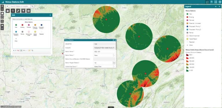
https://www.esri.com/about/newsroom/arcuser/bird-migration/
Going along with conservation work, GIS can be used to help determine where to prioritize conservation for certain species. For instance, GIS can map where the specific type of habitat a particular species likes to reside in, which can help conservationist where to prioritize the protection of their suitable land.
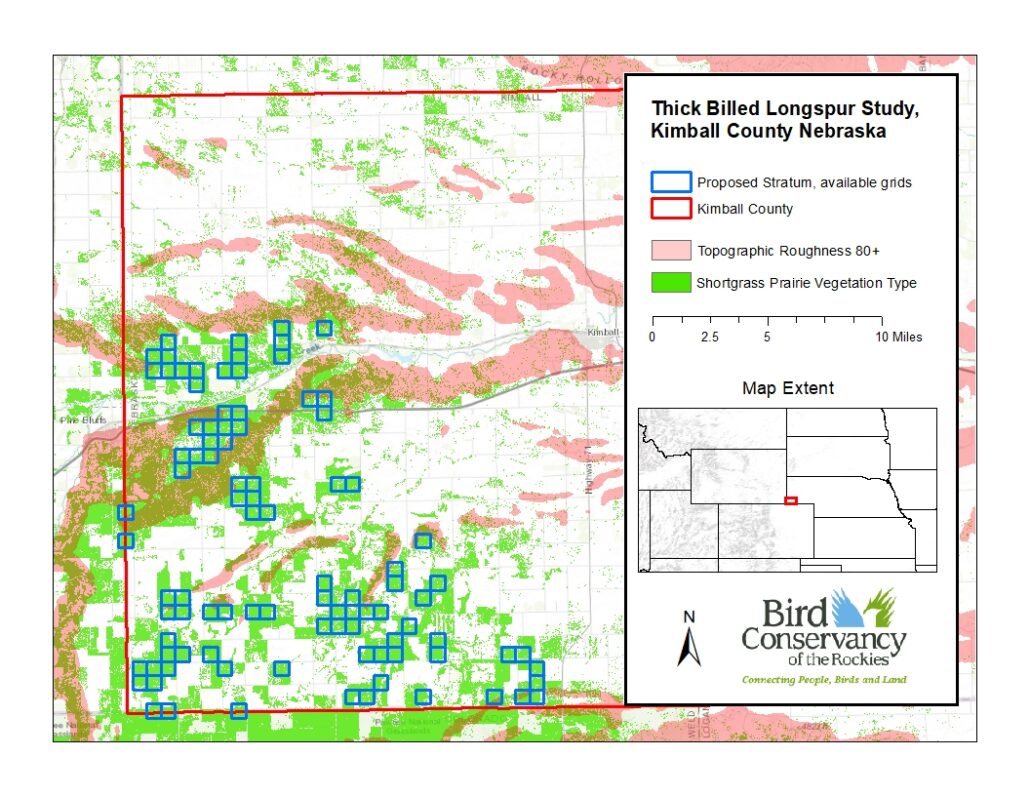
https://www.birdconservancy.org/big-data-for-bird-conservation