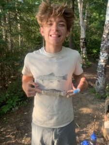
- Hello everyone my name is Logan McFarland and I am a freshman with plans to major in environmental science. I love backpacking, fishing, and generally being outside. I was born in Medina, OH but lived in Granville, OH most of my life. My passion for the environment stemmed from being able to visit many wonderful natural places in my life; even being able to go backpacking in four states just last summer. This picture was taken during a week long backpacking/fishing trip in the upper peninsula of Michigan
.
- Coming into this class I wasn’t really sure what GIS was, where it came from, or how broad its applications are, so this chapter was quite eye-opening for me. GIS is a very convoluted field of geography with a subsequent convoluted history. It was interesting to me that the beginnings of GIS were far before the beginnings of the digital age, and that in the early stages of digital GIS many geographers preferred the manually produced maps. The third section of this chapter regarding the convoluted history of GIS that I had previously mentioned, although relatively difficult to follow, gave me a good look into the subtle differences that scientists debate like: Was GIS a mere descendant of the quantitative revolution or did its inclusion of visual intuition transcend the quantitative revolution itself? I liked how the author recognized that the use of visual means of conveying information rather than text or numerical data is seen as generally “unscientific” but when used in this application is often more efficient at conveying patterns and phenomena. Not to mention patterns that would go unnoticed using tables become the keystone discoveries of GIS. The next section exploring the differences between GIScience and GISystems was equally interesting and and puzzling as the previous section. From my interpretation it is that GIScience is the ideas and theories that are put into application using GISystems, but both require spatial data and analysis to create a mutualistic relationship. The example about the relationship between the spread of Cholera and the use of public wells in London brings to light the importance of local information alongside GIS, but it also shows how tedious GIS can be with much room for error. Previously, I knew that GIS had everyday applications- i.e. GPS- but I did not realize how it is used in almost every aspect of our lives in some way or another.
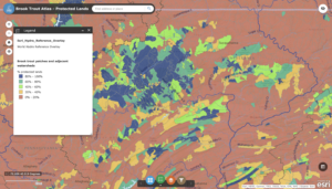
- The first application that I came across came from searching for GIS use for trout fishing. In this application Trout Unlimited used arcgis to show where protected lands cross streams with natural brook trout populations
.
The second application is from the California department of Fish and Wildlife to use GIS to map chemical spraying in an attempt to restore the population of native cutthroat trout in the remote Carson-Iceberg Wilderness. This stream is the only native area for this rare trout species.
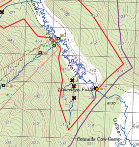 Will Patterson, Ken DeVore. “Restoring Rare Trout to Its Native Range.” Esri, 6 Feb. 2019, www.esri.com/about/newsroom/arcuser/restoring-rare-trout-to-its-native-range/.
1 thought on “McFarland Week 1”
Leave a Reply
You must be logged in to post a comment.
A quick bit of background on a complex subject, but hopefully enough to get you situated with what GIS sort of is!