1)GIS has 5 parts: hardware, software, data, procedures, and people. It manages, captures, and stores data. Spatial data is information that represents real world data. Attribute data is information about spatial data.
Base maps are provided by arcGIS online. it increases the accessibility of GIS and map making/spatial analysis.
Web maps allow information to be retally available to many people at once. On a similar note the open data movement provides the public with accurate data.
Point, line, and polygon data is called vector data.
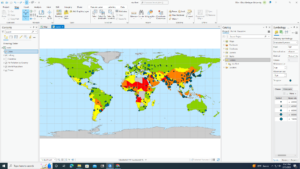
Things that are similar can be grouped into layers on a map.
Raster is recorded or measured data for any location on the surface to form a digital surface.
2)simple technical elements of GIS: map, analysis, insert, and view.
context planes allow you to modify the map
Shows how to connect folders to maps
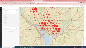
3)created multiple layers to compare the differences.
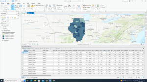
Talks about data relations
Changing attributes
4)using and creating geodatabase
learned how to limit geodatabase highlighting information I think is relevant
Create lines and polygons
5)played with commands, reminds me of coding in high school
Use tasks
Enjoyed the more technical side of gis
Once I worked past all the bugs I enjoyed getting to use the software and I found that there were somethings I could figure out without the book just by poking around. I enjoyed the work i could do with the data tables and reminds me of the coding class I took in high school. I wasn’t able to get the 3d model to work but I was able to work through most of the other stuff. I will take more screen shots in the next chapters I was quite focused on getting the work done.