Chapter 1-
Chapter one was basically going over the basics of GIS. We went over basic map symbology and how to change and manipulate a features symbology to better fit the needs of our map. Chapter one, unlike the other chapters, had us work with ArcGIS online rather than ArcGIS Pro. I assume it’s to help us get familiar with basic functions and features that we end up using in the proceeding chapters. Some key terms that were covered we vectors, rasters, and attributes.
 Chapter 2-
Chapter 2 went more in-depth into topics and terms that we’ve gone over in previous readings. Some of the main objectives we had were to go over more of the basics such as importing map documents, examining and exploring the contextual ribbon, and selecting features. That was primarily in 2a, however, in 2b we started to label features, and base-maps, as well as package and share the maps. Chapter 2c was especially new as it involved creating a 3D scene for the first time and getting familiar with its functions. I thought this chapter was especially fun because it was my first time working with ArcGIS Pro. I, unfortunately, forgot to take pictures of the work.
Chapter 3-
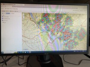
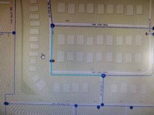
Chapter 3 was one of the more challenging chapters for me in terms of bugs and information that I needed not being included, so I had to skip a step or 2 during the exercises. 3a went into topics like adding additional data to a map, and selecting features by certain attributes. 3b was very intensive on using data tables, as well as using the swipe function. Using the swipe function with separate layers was probably one of the most vital skills I learned during this chapter. Instead of turning off and on different layers of the same area over a period of time I was able to use the swipe function and was able to see a more distinct difference between the different counties that we were analyzing in Illinois. It was easier to see the change and progress over time,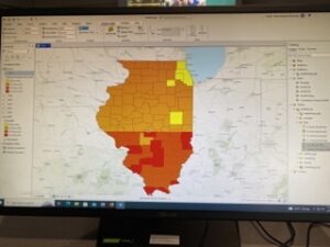
Chapter 4-
Chapter 4 was equally challenging because of technical bugs and whatnot. Chapter 4 was the smallest scale map we had worked with so far, making all of the exercises more precise. This chapter dealt more with specific positions and using x,y coordinates and attribute domains. Towards the end of the chapter in 4c was where I had the hardest time, but it was the most growth I had experienced throughout chapter 4; using and editing different polygons on maps was the most frustrating this I have done so far, but I did eventually get it down. There were also other steps we had previously done that were implemented into this chapter such as linear features that gave us a function we’ve already learned, but used it within a different context, which I thought was useful.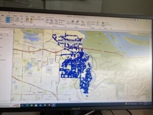
Chapter 5-
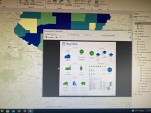
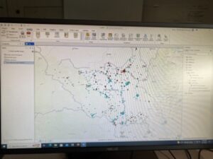
Chapter 5 was very beneficial and unlike chapters three and four, didn’t have any complications. We were given one map layer of conflict within Africa, and throughout the chapter learned to make one base-map layer into several different layers and isolating them into individual countries within Africa. The book had us go through definition queries that allowed us to isolate the layer into one area and one specific conflict, such as riots/protests or violence against civilians. There was also another emphasis on the symbology of a layer, more specifically on graduated symbols to show different concentrations of a specific feature. Towards the end of the chapter we had begun to create new layer files by using Python to script them, which honestly was difficult at first but I can see it becoming a very useful skill later on.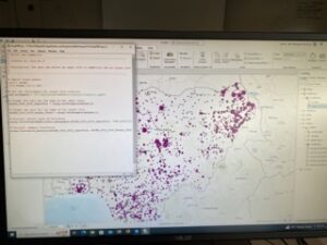
Overall excellent. As I’ve said 146 times, I’m a bit confused by the errors but i’m making changes (external drive, etc.) that seemed to help a bit. But, at the same time, as I’ve said 134 times, it’s good to learn to be flexible and wiggle your way out of problems with ArcPro. They are always there.