Ben Buroker
2/10/23
Geog 191
Dr. Krygier
Chapter 1:
The section about spatial data and attribute data was interesting. This might help design research questions and allow me to understand if I have the necessary data to answer specific questions. An example is that the location of a hospital is spatial data, information about that hospital, like name, available rooms, specializations, staff, and patients, is all attribute data. With this data, it is possible to perform spatial analysis and understand the patterns and other ways in which the hospital works. It’s crazy about how easy it is to make a web map nowadays and how accessible GIS has become. I feel like knowing how to make a web map and share it online will be useful for the research I’m doing with Dr. Rowley.
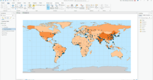
Arc Online Activity 1: I don’t know how to do the step that says, “In the context pane, click Configure pop-ups…” on page 26.
I was able to finish up the exercise from chapter 1, and everything was looking great but as soon as I finished the last step, the School Walking Areas all disappeared from the map. Even though all of the layers are visible. I trouble-shot it but was unable to make them reappear so I’m a bit stuck on that.

Chapter 2:
This chapter starts right up with exercise 2a in Arc Pro on the desktop. I had a really hard time finding the World_data.mxd file to import into ArcPro. I think that the issue was that I was trying to save my project to my personal external hard drive (?). As soon as I made a new map and saved it to the computer, the file was the first option right there when I tried to import a map…
Above is what my map looked like at the end of 2B. I then attempted to complete exercise 2C, which is experiencing 3D GIS, but was not able to find the buildings.shp file that I was supposed to use for this exercise. It is not where the book says it should be and I was not able to find it or get it to miraculously show up no matter what I tried.
Chapter 3:
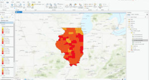
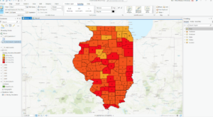
This was what my map looked like after completing exercise 3A+B/ I tried to add the IL_med_income.lyrx to the map but it just went on top of the existing layers and I couldn’t figure out how to make it go beneath and show up as pretty dots like in the book.
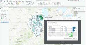
This is my map after exercise 3D. 3D had a lot of different things that we had to do, and I encountered small hiccups that I was able to fix/work through. I think a lot of the issues I dealt with were my own fault and a result of me trying to go too fast and not fully reading the instructions.
Chapter 4:
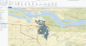
This is the map that I ended with for Chapter 3. I struggled at the end of this chapter when the book asked us to use the “edit vertices” tool in the eastern part of Illinois for that small map section. I couldn’t properly select the line using “bookmarks”, I don’t think I ever made any bookmarks.
Chapter 5:
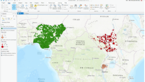
This is the map I ended with after Chapter 5. This chapter went pretty smoothly and I feel like I was learning how to properly navigate bringing the data into the map. This whole time I was having issues finding the data the book was asking me for. I figured out how to search within the catalog pane and learned that if I typed in the exact file name (or something close) it would show me the files even though they seemed hidden or out of place. This was kinda a duh moment, but was key to me being able to actually efficiently work through the lessons.
Overall Reflection and “Big Ideas”:
I struggled initially because I didn’t download the data from the very beginning of the book, after I downloaded it and solved that issue things got a lot easier. It was still hard to find the data and sometimes it wasn’t in Arc Pro or even in the folder connection. I thought that having the ability to use the files already in the data folder in order to start the next exercise with a fresh perfect map was really useful. Instead of being totally stumped by one hiccup, if you couldn’t figure it out you could go ahead and start again. I had a hard time thinking about big ideas while doing these chapters. I think I was overwhelmed with the amount of exercises there were to do as well as by how confusing the stuff we were doing was. Most of the time I felt like I wasn’t able to understand how the processes I was doing were connecting to a bigger goal for each map. The names of the tools and the number of steps we had to do before seeing any change in the map made me forget about what we were doing. I appreciated seeing some connections to the work we did in the OG GIS class, like joining attribute tables. As I was working I was thinking about if I would be able to replicate any of the steps I was doing, either apply them to a unique dataset, or to recall the steps and be able to do them again. I definitely couldn’t without the instructions.
“I feel like knowing how to make a web map and share it online will be useful for the research I’m doing with Dr. Rowley. ” heck yah
” I finished the last step, the School Walking Areas all disappeared from the map.” noted. this didn’t happen for everyone. i have no idea. i’ve said that over and over.
“I encountered small hiccups that I was able to fix/work through.” heck yah. that’s gis. hiccups with perseverance.
“I had a hard time thinking about big ideas while doing these chapters. I think I was overwhelmed with the amount of exercises there were to do as well as by how confusing the stuff we were doing was. Most of the time I felt like I wasn’t able to understand how the processes I was doing were connecting to a bigger goal for each map.” this course is a different model than 112 and both have their benefits. this one tosses more concepts and software at you, somewhat superficially. but it’s over in half the time. the next step is to do what we’ll do in the final exam: get some real data and do something. I’d say that taking on some Rowley stuff (whatever it is) and making it work is another thing you can do. This class will plant stuff in your head that may not make complete sense, but through the marvel of HUMAN MINDS it will help as you work through real applications. And doing GIS is the only way to get good at gis.