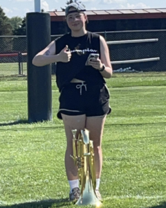
My name is Ellie, I am a sophomore environmental science major. I am from Louisiana but was born in Columbus. I love nature and being outside so it was easy for me to decide what to study. I decided that GIS would fit well with my major. I am so considering adding a geography minor. I don’t have many photos but this is one of me from marching band this year!
My knowledge of GIS is limited so I really enjoyed the breakdown provided in Schuurman chapter 1. The first thing that stood out was the wide success that GIS has had on our society compared to the lack of knowledge the typical person has on GIS as a whole. It has been integrated into a vast range of disciplines such as: disease tracking, archeology, and consumer based markets such as coffee shops like Starbucks. We discussed the use of maps as a form of influence in Human Geography and I did not realize exactly how much influence GIS could have at the time.
I had no idea there was controversy regarding GIS. The chapter gave a very inclusive and blunt overview of GIS and the positives and negative. I enjoyed the point of view the author provides as someone within the geography community. I learned GIS is viewed differently by people within the community. Some view it as just an application and others view it as a science. The common ground between GIsystems and Giscience is the practices that defines them. GIsystems is often stated to be the data input, special analysis and mapping side of GIS. GIscience was more defined as the theories behind the system. I will be curious how I feel about this distinction after I take more geography classes.
The technical history was my least favorite section to read but it is important to know. The fact that GIS got its beginnings prior the the rise of computers was something I had not considered as a possibility. It does make sense in hindsight though. I would enjoy learning more about the evolution of GIS as computers evolved in the early 2000’s.
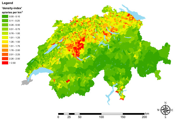
I searched “GIS application honey bee” and found an article published in 2019 “High-resolution maps of Swiss apiaries and their applicability to study spatial distribution of bacterial honey bee brood diseases” This article describes the lack of GIS application to study honey bee diseases and gives the first step towards standardizing the use of GIS in Europe by providing high-resolution maps of the apiaries. This article was also highly cited in recent years.
Cite
2019. High-resolution maps of Swiss apiaries and their applicability to study spatial distribution of bacterial honey bee brood diseases. PeerJ 7:e6393 https://doi.org/10.7717/peerj.6393
I also decided to search “GIS application East African Rift Systems”. I did a research project on the EARS for physical geography and I knew there would be some overlap. I found the article “Impacts of Mau Forest Catchment on the Great Rift Valley Lakes in Kenya” . This discusses the deforestation and its relation to the reduction of water in the lakes in the area.

Cite
Boitt, M. (2016) Impacts of Mau Forest Catchment on the Great Rift Valley Lakes in Kenya. Journal of Geoscience and Environment Protection, 4, 137-145. doi: 10.4236/gep.2016.45014.
you should have searched for “marching band” gis:
https://storymaps.arcgis.com/stories/61cd4da0ebab43babccf24b72eafb52e
the GIScience (concepts, theories) and GISystems (technology) is more of two complementary parts of the field. They both influence each other, but the concepts tend to drive the technology. The bit of controversy tends to come from more broader ranging critiques about the origins and limitations of GIScience itself, more qualitative and social perspectives.