Chapter 6:
- Domains provide a way for you to constrain input information by limiting the choice of values for a particular field, helps maintain data integrity
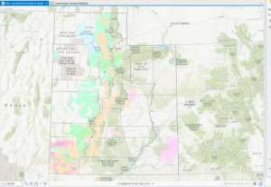
- Organization – shared online workspace that is tied to your software license
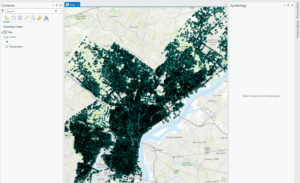
- Tree inventory map allows urban forest managers ti identify areas in which tree conditions can be poor and prioritize maintenance
Chapter 7:
- Geocoding- create features from information that describes or names a location, typically an address
- Address table
- Reference data
- Address locator – file contains the reference data and various geocoding rules and settings
- Buffers are polygons that are created around a feature at specified distances
Chapter 8:
- Temporal data – data that has a time attribute
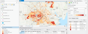
- Hot spot analysis – determines which areas are significant, including areas that are hot and cold and areas that are not significant are white
- Space-time cube – helps visualize the data, the bins can be viewed in 2 or 3 dimensions and can show patterns of incidents over time
Chapter 9:
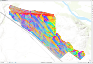
- Cells – raster is composed of a grid of cells, instead of discrete x,y coordinates that define geographic entities
- Discrete data – shows distinct and discernible regions on a map, such as soil type
- Continuous data – there are smooth transitions between variations in the data
- Map algebra – language that combines GIS layers, is fundamental to raster analysis
- NoData – no values were recorded in cell (not the same as 0)
- Mask – means of identifying areas to be included in a geoprocessing operation
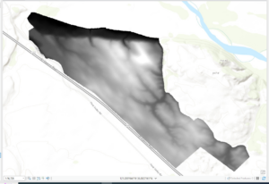
- Hillshade – surface layer that depicts shadows to model the effect of an illumination source over terrain of the land
- Azimuth – the direction of the sun, expressed in positive degrees
- Altitude – angle of the sun above horizon
Chapter 10:
- Labels – based on one or more feature attributes and placed near or on a feature
- Label class – used to specify detailed aspects of how labels are positioned and symbolized
- Map frames – containers for maps in your page layout
- Scale bar – dynamic element that provides an indication of the size of a feature and distance on the map
Nice overview of a bunch of important concepts. Lots of stuff. Pretty pictures.