Final: For the first section I decided to do a survey. Because the library is no longer functioning as a library, I thought it would be interesting to collect data on where OWU students like to study in Delaware. I used Survey123 to create a survey. Personally, my favorite place to study is off campus so I added a feature that allows the person taking the survey to select on a map where their favorite study spot is. Here is a link to my survey, https://arcg.is/CmKbn I shared it with the public so it should be available to all. For the second section I decided to create a dashboard looking at drug overdosing in Ohio. I also added the layer of US Highways because I wanted to highlight the correlation between the two. I can’t figure out how to add it as a link on here, but it is public on my dashboard so I think that should be okay and relatively easy to find. It is labeled Ohio Drug Overdoses.
Author: metuttle
Tuttle Week 6
Chapter Seven: 3D was the bane of my existence in GEOG 291. I was not thrilled to see it back for the online version. I can’t say that I was overall surprised to see it but safe to say I was not thrilled when I opened up the chapter. Overall this section has been a lot easier to work with than the ArcGIS Desktop so I have higher hopes than what I accomplished during the 3D chapters last module. Tutorial Seven: Okay I came in with a chip on my shoulder. I actually did not mind this tutorial at all. It was much easier to deal with than the desktop version and I think it was really cool getting to make the map look exactly how I wanted it. I do wish there was a way to add the decals in the excel file. That would make manipulating the graphics much easier.
Tuttle Week 5
Chapter Six: Learning about handling real time GIS objects was interesting. It continues to overwhelm me a little bit that all of this data just exists and is collected for anyone to use. This is a little silly, but I think the biggest thing I learned from this chapter is just the simple importance of time and the different data types. Moving, discrete, stationary, and change were laid out so simply in this chapter and it was very easy to digest. Tutorial Six: Tutorial 6 was cool to see how to make a map. I can see myself making something like this for my final project. The second half of the tutorial was definitely easier than the first half. The first half I had a hard time following because the textbook was not really telling me every word that I needed to know.
Tuttle Week Four
Chapter Three: Getting to know the experience builder. In the experience builder you can essentially code without coding. This is so interesting because I am able to add data from a public database and make it engaging without having to necessarily pay a fortune. Widgets are also so interesting because it allows the map to be interactive. Tutorial Three: 3.1 was fairly easy until I got to add a picture. I do not possess that ability because I am working with the sketchy online version of the textbook. I moved on to 3.2 once I realized I was stuck. The rest of the tutorial was easy. I could get through it. The only difference is that the aesthetics were slightly off because of the lack of picture. It was really cool to be able to add all of the information about hurricanes and earthquakes.
Chapter Four: Mobile GIS is a very cool way to create a simple application and how to do it on the go. Like the tutorial said, we live in a post PC world. Getting to make editable layers and design projects is such a unique skill that I will have once I am done with this class. Tutorial Four: The start of chapter 4 tutorial was really fun and intuitive. Once we got deeper into the tutorial it got more confusing. I had a hard time following it to be honest. It did stick with me just how easy it was to collect that survey data. I wish it didn’t make me download the app. I think that is one downside is that if it’s on mobile there might have to be an app. Less people are likely to fill that out when against say a google form.
Tuttle Week 3
Chapter One: This was mostly an introduction to WebGIS and spent a lot of time going over exactly what it is. I think this was helpful because although I have already taken GEOG 291 and become familiar with ArcGIS, I am fairly oblivious to the information that the first chapter talked about. I found it interesting and honestly exciting that so many people could be connected through a website like this. Being able to connect and share information on a worldwide scale is something that I just knew nothing about before this. I am excited to learn how companies and individuals alike take advantage of WebGIS and how I can take advantage of it too. The tutorial one was also a very basic introduction to the software. I used my hard drive to download the zip file which took much less time than it did when I tried to do it in 291. It was way more intuitive than ArcGIS was. I enjoyed working on the app more than the map. Both were cool and I am already really excited to figure out how to make an app and what ideas I have for the final project.
Chapter Two: My biggest takeaway from this chapter was the different mapping styles. I enjoyed getting to see the different types with a little picture and sample description. I liked that a lot. I still am in awe of how exciting the online version of this is. I know I am the last person on earth to know about WebGIS but it is still so cool to me. Tutorial two was so interesting. It gave me big Apple website energy for the last few sections. I am enjoying slowly learning about the content without being thrown into it. I feel like that is a big difference from the first module. This is much easier to understand and I think it is more intuitive
Tuttle Week 1
My name is McKenna. I am a junior exercise science major environmental science minor. I took the first module earlier this semester. I am looking forward to learning more about the online version. My computer is simply too old to handle the online version, so I get the luxury of using desktop computers throughout campus.
I noticed that there is a place where I can add a profile picture and a bio. I feel like that would be overdoing it a bit as I introduced myself moments ago. The Esri Academy is really interesting. It looked like I needed an invitation. Maybe after the course I can look into getting connected and building more knowledge about GIS
It appears that ArcGIS Online is meant to work with a wider variety of people than the ArcGIS Pro that we worked on in the first module. I also noticed that there is an app. It would be cool to use the app later in the semester and connect it to our ArcGIS account. That being said, there was a whole bullet point in the article that talks about connecting the online version to Pro. I had a really hard time connecting to the online version in the first module.
I enjoyed taking the class. It didn’t quite take me the whole two hours that I allotted for which is a relief. I thought it was really cool how we could create instant apps that make it a lot easier to share with someone. It’s a smart tool that someone created to make sure that they could pass information quickly. I thought the course itself was intuitive and easy to follow along with. I haven’t carefully read the entire syllabus, but I hope we do another training module or two before the semester is over.
I looked at nursing home evacuations versus shelter in place during hurricanes. I looked at this specifically by looking for a connection between ArcOnline and physical therapy. The researchers found that this was really the first study of its kind. They proposed continued use of GIS to establish a protocol to ensure that the most vulnerable are safe
Sakib, N., Hyer, K., Dobbs, D. et al. A GIS enhanced data analytics approach for predicting nursing home hurricane evacuation response. Health Inf Sci Syst 10, 28 (2022). https://doi.org/10.1007/s13755-022-00190-y

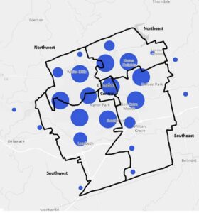
This second map depicts clustered sport delivery points in the five City of London Ontario planning districts. It is mapping the different hot spots of organized sports. Organized sports are a clear indication of an active individual. I looked specifically for youth sports but I think the online version might not have the layers. This paper did organized sporting events overall.