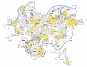
To start off I really had issues saving and reloading information from previous tutorials. I couldn’t find my data that I had submitted for Ch3 on the ArcGIS Online site. When I opened my ArcPro in the computer lab, my maps did not change when I was clicking buttons to do the Ch 4 tutorials. I continuously had issues altering my maps and view my previous projects. Maybe I had done something wrong when saving all of my progress, but I couldn’t find any of my old work or make new progress in the tutorials. So I didn’t have a ton of notes on getting all this done, but I did manage to get it finished.
Author: argrogan
Grogan – Week 4
Chapter 1
To start this assignment, I like how the tutorial book explains how each button you click changes the map in a specific way and you can see the differences. I appreciate how straightforward they are in explaining each step of viewing the maps. As I went on, tutorials 1-2 explained the movement and navigation programs. I appreciated that one false move wasn’t going to ruin my entire progress as the undo button became my best friend several times. I was able to better understand where everything was within ArcGIS. When it came to tutorial 3, I started to work with actual data points. I was able to pull up different statistics and look at an attribute table. As well as edit it for different reasons and look at the summary statistics. Tutorial 4 I had some initial issues pulling up the symbology for the FQHC clinics but I just didn’t have the valid data source on the layer. Once I got that hiccup dealt with I had no issues with the rest of Chapter 1 practice with 3D maps.
Chapter 2
I took my time with this chapter since it was a bit more challenging. I enjoyed working on symbolizing maps and creating custom scales to suit my needs. The most confusing part for me was deciding which methods to use for choropleth maps. It seems like you really need to grasp statistical concepts, like data distribution, to make the right choice. I’m worried that when I start working with my own data, I might struggle to pick the most suitable scales for the best results. Another tricky part was the definition query, mostly because I’m not very tech-savvy, so it was a bit outside my comfort zone. However, I did learn some useful skills, like how to remove duplicate labels, adjust font sizes and colors, and explore more advanced 3D map features. One feature I found especially interesting was the Visibility Range option for feature layers. It allows a layer to appear or disappear depending on the zoom level, which helps make maps less cluttered and easier to navigate by only showing data when it’s at the right zoom level.
Chapter 3
It began by teaching map layout techniques, including adding legends, using the ruler to align elements, and exporting maps. These skills felt especially useful for creating educational maps or preparing professional presentations. The chapter also covered how to create charts based on map data, like a graph that focused on the employment statistics of just 10 states, making it easier to visualize trends without being overwhelmed by a larger dataset. The tutorial then shifted to ArcGIS Online, where I learned how to share maps and create StoryMaps. While I had some experience with ArcGIS Online, there was still a bit of a learning curve. It seemed intuitive and user-friendly but lacked some of the advanced features of ArcGIS Pro. Creating a StoryMap was fun, though it would’ve been even better to use my own words and data instead of just copying and pasting. Overall, the chapter gave me valuable experience using ArcGIS Online to create interactive maps and reach a wider audience with visually appealing presentations.
Grogan- Week 3
Chapter 4 focuses on the importance of file geodatabases (FGDBs) in GIS, particularly for efficient storage, organization, and querying of spatial data in ArcGIS Pro. Before reading this chapter, I didnt’ have a full grasp of the significance of FGDBs. However, I quickly learned that spatial data in GIS has geographic features, making it more complex than simple tables. FGDBs allow for fast queries and spatial relationships, which reminds me of databases in bioinformatics. One of the most valuable insights was that FGDBs allow the storage of multiple layers efficiently, and they provide better performance compared to traditional shapefiles. I now understand how much more flexible and organized FGDBs are, especially for large datasets. If I see a .gdb folder, I now know it holds many classes, raster datasets, and tables. The chapter also provided hands-on tutorials, such as how to create geodatabases and import shapefiles. One of the tutorials involved summarizing crime incidents by neighborhood, which I found particularly interesting from a Data Analytics perspective. Additionally, I found Python’s integration with ArcGIS valuable and would love to explore how it can automate geodatabase tasks. Some lingering questions include whether FGDBs have limitations for large environmental datasets, which I hope to explore further.
Chapter 5 deepens my understanding of how maps can reveal hidden patterns and serve as powerful tools for decision-making. Before this chapter, I hadn’t fully appreciated the significance of mapping areas and how it can uncover insights that raw data tables cannot easily reveal. For example, maps can show where the highest crime rates are in a city or identify hospitals within a 5-mile radius of schools. By condensing and summarizing complex data, GIS helps make sense of vast amounts of information. I was already familiar with latitude and longitude but had no prior knowledge about map projections and coordinate systems, which initially felt like learning a new language. I learned how selecting the wrong projection could misalign datasets and severely distort analysis, which made me realize the importance of choosing the right projection for accurate results. Additionally, the chapter introduced vector and raster data, which I found especially intriguing. I related raster data to microscope images, where grids and pixels have different intensities. The tutorial demonstrated how critical it is to align datasets properly using the correct coordinate system to avoid errors. Surprisingly, I enjoyed working with coordinate systems, even though I had struggled with geometry in high school. Real-world applications of GIS, like the ability to analyze geographic data for decision-making, made me appreciate its power even more. I also learned about spatial data interoperability, which refers to how different datasets can work together seamlessly. My lingering question is about how datum transformation might affect the precision of GIS analyses.
Chapter 6 emphasizes the importance of proximity and spatial relationships for decision-making, such as finding the nearest hospital or analyzing wildfire risks. I appreciated how practical the chapter was, showcasing how GIS tools can automate workflows and solve real-world problems efficiently. One of the key takeaways was learning about geoprocessing tools, such as dissolving features to merge school districts into larger regions, clipping data, and merging datasets—tasks that are essential for handling large environmental datasets. What stood out to me was spatial intersections, where two datasets are overlaid, and the affected area is extracted. This concept was mind-blowing and made me realize how powerful GIS is for analyzing spatial relationships. A significant real-world application I found particularly fascinating was how emergency services use geoprocessing to assign fire stations to fire zones while ensuring response times meet requirements. The chapter also touched on calculating straight-line distances, which represent the shortest possible path between two locations. While this is simple, it’s often unrealistic in real-world scenarios, as factors like driving routes, sidewalks, and crosswalks must be taken into account. GIS isn’t just about mapping; it’s about solving practical problems in everyday life. I also began to consider how GIS can handle large datasets during geoprocessing. I wonder if this process would slow down with larger data sets or how GIS can integrate road issues and other real-world factors to calculate more accurate analyses. Overall, this chapter gave me more confidence in using ArcGIS Pro. Initially, I struggled with understanding the purpose of GIS, but now I feel much more equipped to apply these tools for meaningful analysis and decision-making.
Just overall all that I have learned about GIS so far has been fascinating and the amount of detail that all of this entails has been super interesting for me to learn.
Grogan Week 2
In Chapter 1 of the Esri Guide to GIS Analysis, primarily the fundamentals of GIS are explained. GIS analysis is looking at geographic patterns within specific data and looking at the connection relationships. The steps to GIS analysis include asking a specific question, choosing the method that works for the data you are trying to discover, processing the data, and reading the results. Similar to GIS analysis I’ve participated in biological studies where it is better to get a more specific question when doing an experiment to get specific data. When reading the results at the end, there are specific types of features to look out for on the map. Those include discrete, continuous phenomena, or summarized by area. To me I would think discrete would not mean any specific location, but in fact that is quite the opposite. To me, I feel the most common feature is the features summarized by area. I also feel they are the easiest to read because of the clear area boundaries that they have. The two models that represent features are vector and raster models. I prefer the vector models because I prefer having hard boundaries when reading a map in most instances.
In Chapter 2 it features the actual mapping process. It emphasizes the need to carefully select the amount and type of information included in a map, depending on its intended purpose and audience. For example, urban planners may require a map with categorized road types to inform their decision-making, while a tourist map of a park should prioritize simpler information to aid navigation. Including too many categories or too little can either overwhelm the user or make the map difficult to use. The chapter also covers various methods for analyzing geographic distributions, such as finding the “center” of a cluster of features, which can be defined using different statistical measures like mean center, median center, or central feature. These centers help understand patterns like crime distributions or the most central locations in a set of data points. For example, a crime analyst may use GIS to track changes in crime patterns by comparing the center of auto thefts during different times of day. A key takeaway is that outliers can skew the results of these calculations, especially when there are fewer data points. Additionally, the chapter discusses how GIS maps rely on coordinate systems and data tables to assign locations and generate visualizations. The complexity of a map should align with its objective, balancing enough detail to convey meaningful patterns without overwhelming the viewer. Proper map scaling and categorization are essential for clarity, as too much detail or too broad a focus can obscure the main message the map is meant to communicate.
Chapter 3 of The Esri Guide to GIS Analysis, Volume 1 focuses on mapping quantities to reveal patterns and relationships between features. The key idea is that mapping the most and the least of something helps identify areas that meet specific criteria or require more resources. The type of data being mapped—whether counts, amounts, ratios, or ranks—determines how it should be represented. Once the data is classified, the map can use different symbols or group values into classes to make the patterns easier to visualize. To map quantities effectively, a standard classification scheme such as natural breaks (Jenks), quantile, equal interval, or standard deviation is used to group similar values. This helps identify patterns like clusters or trends in the data. Visualizing the data with bar charts can also aid in selecting the right classification scheme. Several mapping techniques are discussed in the chapter based on the type of data and features being mapped. Graduated symbols are ideal for mapping discrete locations, lines, or areas, while graduated colors are better suited for discrete areas or continuous phenomena. Charts are used to map data summarized by area, and contour lines show the rate of change in values across a spatial area. For visualizing continuous data, 3D perspectives are employed, where the viewer’s position and other factors like the z-factor are manipulated to provide a detailed view of the surface. The chapter stresses the importance of selecting the right map type and classification method based on the data’s characteristics and the map’s purpose. A well-designed map will clearly highlight where the highest and lowest values are, providing valuable insights into the distribution of the data.
Grogan Week 1
Hey, my name is Abbie Grogan. I am a junior and I am a Pre-Professional Zoology major with a chemistry minor. I am a captain of the women’s lacrosse team and a part of Kappa Phi, the PreVet club, and I work as a vet tech. I enjoy relaxing in my free time and trying new food.
Going into this course, I have very limited knowledge of GIS systems and applications overall. I did know their importance but I was not aware of the vast variety of uses that they can be applied for. After reading Schuurmans first chapter of GIS: A Short Introduction, I enjoyed learning the history behind the GIS development and how its uses grew over time. From this I was able to determine that GIS analysis has had very impactful implications for cities, social trends, health patterns, and environmental issues. I did not know how widely they could be used. To be completely frank, I was not expecting to truly enjoy this reading but I was captivated by the unknown importance of this type of tool.
The first application I came across was emergency response planning. In emergency situations. One team called the Center for Robot-Assisted Search and Rescue (CRASAR) collected aerial imagery that helped to create vital GIS maps that visualized Hurricane Ian’s impact and guided emergency responders to find those in need of rescue faster than ever before. Using GIS, areas of risk and vulnerability are highlighted by combining critical infrastructure, hazard, and demographics data into a single map.
https://www.esri.com/about/newsroom/blog/hurricane-ian-searchers-shared-map/
The second application I found was related to neighborhoods that use emergency departments within North Carolina. This specific GIS shows the changed in ED use over 2 years depending on the neighborhood they were in.