Chapter 7:
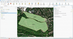
I found this chapter really fun, especially during the sections on creating, deleting and smoothing polygon features. I feel like this specific part of the textbook will be extremely helpful to me for the final portion of the course as I apply what I’ve learned in imaginary GIS applications. This chapter leaned more towards manipulating and creating your own data points and polygons rather than working on ones we’ve been given thus far. While being one of the shorter chapters, I feel like this is the one I will be applying the most.
Chapter 8:
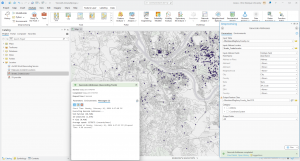
Chapter 8 was also one of the shortest chapters we have had to do for the course, and it provided a lot of useful information about geocoding (a GIS process that matches location fields in tabular data to corresponding fields in existing feature classes) using zip codes. It also gave a step-by-step guide on how to geocode using street addresses using the sample data we were given. A key step in this process is knowing how to use the Geoprocessing tool on different data layers, which the textbook explained in great detail. I will be referring to this chapter a lot in the future, not just during the final but in my other courses that require a base level understanding of GIS.
Chapter 9:
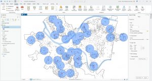
I found this chapter extremely interesting, as it gave me a lot of the base level information I will need to complete the Final for this course. It explained how to create and use buffers for proximity analysis, as well as how to use multi-ring buffers. Buffers can be very useful to policy-makers when they want to visualize the number of people who could be affected by a specific policy, as well as estimating travel distance or time on a street network. Learning to use the Pairwise Buffer tool, the Multivariate Clustering tool and how to perform Network Analyses was very helpful to me, and I will be applying a lot of this knowledge in my Final.