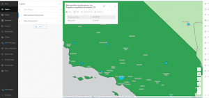
Chapter one familiarized us with a component of our class ArcGIS Pro by starting the tutorial and putting into action what we’ve been reading about. we worked with a finished map in ArcGIS pro that had locations of urgent health care clinics in Allegheny county, Pennsylvania. We started by reviewing key terms and going over the basics of the map such as the different layers. Then we learned how to navigate the map optimally. Then we reviewed attributes. and finished with being introduced to symbology on the maps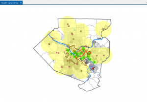
Chapter 2 we learned how to design and symbolize thematic maps. A thematic map strives to solve or investigate a problem. they consist of a subject layer or layers placed in spatial context with other layers. The subjects of thematic maps are commonly vector layers because such layers often have plentiful quantitative and qualitative attribute data that is essential for analysis. However you can of course use raster layers. Spatial context layers can be vector and theses layers can be in either raster or vector formats including many basemap layers provided by ESRI. I had to however had to skip over a section in chapter 2 section 4 because the attribute table was completely blank. 
Chapter 3 the next chapter is about sharing the maps we just worked with people who don’t have access to ArcGIS pro or who do not have gis skills beyond basic map navigation. In the first tutorial we built a map layout with 2 maps this giving us a the skills to build any kind of layout with one or more maps. Section two we shared ArcGIS pro maps and published them in ArcGIS online as web maps and performing extra work on them using ArcGIS map viewer. next we learned about creating a story in ArcGIS story maps. we finished out with creating a dashboard in ArcGIS dashboards.