Chapter 7:
Chapter 7’s focus was on digitizing. The concepts learned in this chapter include editing polygon features, creating and deleting polygon features, using cartography tools, and transforming features. I found this chapter much easier to understand than the previous chapters and didn’t have any trouble following it.
Chapter 8:
Chapter 8’s focus is on geocoding. What was gone over in this chapter was geocoding data using zip codes and geocoding using street addresses. I was having trouble getting the program to run the Collect Events tool as it kept coming up as an error. Other than that, I think this chapter went pretty smoothly.
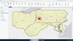
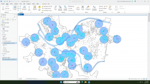
Chapter 9:
Chapter 9 is all about spatial analysis. In the chapter we learned about using buffers for proximity analysis, using multiple ring buffers, creating multiple ring service areas for calibrating a gravity model, using network analysis to locate facilities, and performing data cluster analysis. Honestly this chapter felt pretty complicated. I was definitely struggling more than I was in previous chapters. I was especially having trouble in 9.3 trying to symbolize the output polygons as I for some reason could not get them to show up.