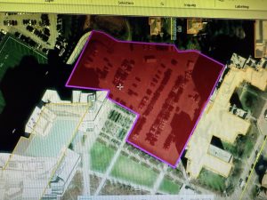
Chapter 7 – This chapter went over a little bit about how you can both create and edit different features on the map. More specifically it went into working with polygon features and how to use those. It went over how you can make your maps and features look smoother by using things such as cartography tools and working with CAD drawings. Overall the chapter just mostly worked with creating and editing GIS features.
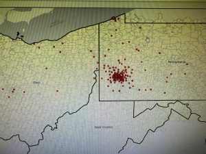
Chapter 8 – this chapter didn’t have a ton involved in terms of how many tutorials there were, but I definitely think it was a lot more complex than a lot of the other chapters and tutorials I have done. It was a little bit complicated and not necessarily one of the things I would catch onto quickly, but it’s important information to know about GIS. You learn a lot more about the whole geocoding process in a more complex, detailed way. You can use things such as zip codes and addresses to geocode in this chapter.
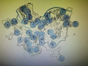
Chapter 9 – Chapter 9 is also a decently complex chapter that goes into a lot of detail with spatial analysis. It really looks into different buffers and how you can use that for proximity analysis. It teaches you how to use those buffers and how you can create multiple to use it for locations. It also goes into methods such as service areas, clustering, and location models.