Chapter 7:
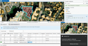
- You can manually digitize a map by creating new map features, as well as editing existing ones.
- You can make edits to specific features or groups of features, including rotating them, moving them, and or changing their specific shape.
- You can import CAD drawings into the software to create more detailed features, or to make ones that match architectural drawings exactly.
- This chapter mostly focuses on the various tools available for creating specific features, and how to modify and import existing ones
- .

Chapter 8:
- This chapter was all about Geocoding data
- Geocoding matches input data to specific locations or features on a map, which can be useful for a variety of purposes
- Geocoding uses a fuzzy search method, and tries to match the most data, rather than making the most accurate matches possible, in order to account for error in the users input
- You can tune the parameters of the search to make it more or less strict, with higher strictness giving better accuracy, and lower strictness giving a higher match count.
- You can geocode to match various features for varying levels of accuracy depending on your data, such as county vs streets
Chapter 9:
- This chapter focuses on different spatial analysis tools that can be used to gain insights about data
- Buffers are a region that surround a feature out to a certain distance, sort of like circling the feature or feature class
- Buffers allow you to select only the data that falls within their radius, and the radius can be based on distance or travel time depend on application, and can also be graduated to show regions within different distances of the feature
- Network analysis allows you to select specific features within a feature class based on sets of conditions, or can allow you to optimize an already existing network
- Cluster analysis allows you to find clusters of data points that are similar or close to each other, and groups them, and then assigns them a vector in 3D space(?) representing the data point(?)